Catalog Archive
Auction 132, Lot 295

"Map of Texas from the most recent authorities", Williams, C. S.
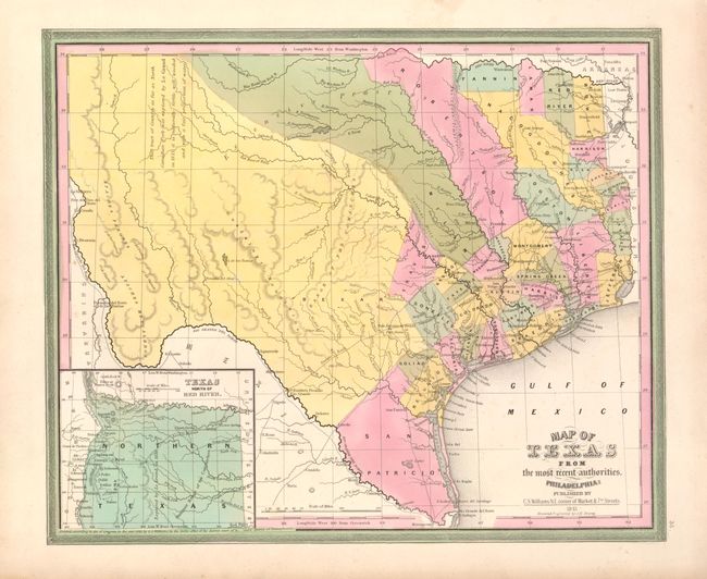
Subject: Texas

Period: 1845 (dated)

Publication: New Universal Atlas

Color: Hand Color

Size:
14.5 x 12 inches
36.8 x 30.5 cm
Download High Resolution Image
(or just click on image to launch the Zoom viewer)

This is a very early map of the new state of Texas drawn by J.H. Young. It portrays early counties, towns, and villages and shows "Texas North of the Red River" in an inset at lower left. This panhandle extends north to the Green Mts., just west of Pikes or James Peak in present-day Colorado, and west to the Rio Grande River, thus incorporating Santa Fe and Taos. There is a comment taken from Arrowsmith's 1841 map in West Texas that the area "as far as North Canadian Fork was explored by Le Grand in 1833, [and] it is naturally fertile, well wooded, and with a fair proportion of water." San Patricio County occupies the south tip, while Bexar, Milam and Robertson counties take up the majority of the western region. Several early roads are depicted including the Presido Road, and Fort Alamo, mines, and the Presidios of Rio Grande, del Norte el de las Yuntas, del Paso del Norte are identified. The county configuration involving Lamar and Nacogdoches counties has been changed from the first edition. Still dated 1845 and retaining Williams' imprint, but published in the 1846 edition of the New Universal Atlas, just after Mitchell acquired it.

References: Day (TX) #34 & 108.

Condition: A+

Superb original color with just a hint of toning at paper edges, well away from the map.

Estimate: $900 - $1,200

Sold for: $1,300

Closed on 6/2/2010

Archived