Catalog Archive
Auction 132, Lot 258

"[Lot of 3] Tennessee [and] A New Map of Tennessee with its Roads & Distances from place to place along the Stage & Steam Boat Routes [and] The Rand McNally New Commercial Atlas Map of Tennessee",
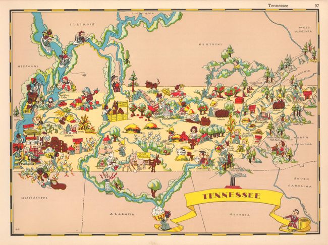
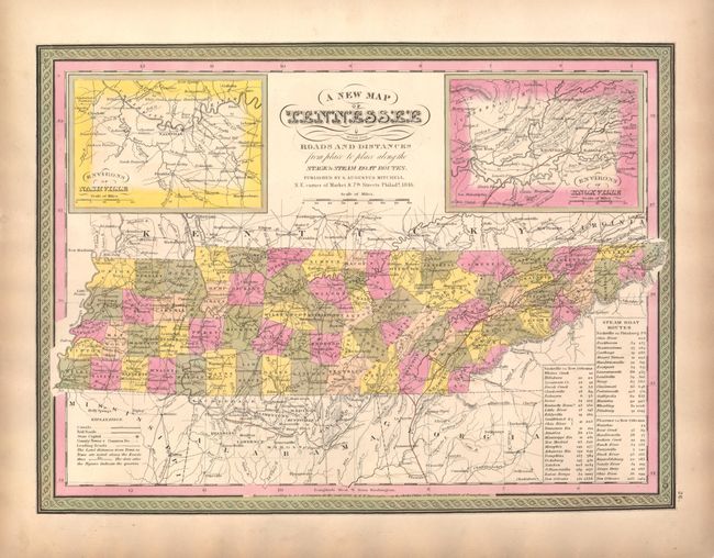
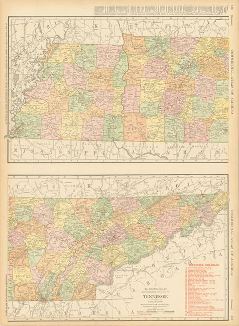
Subject: Tennessee

Period: 1846-1935

Publication:

Color:

Size:
See Description
Download High Resolution Image
(or just click on image to launch the Zoom viewer)

1) Tennessee, by Ruth Taylor White, from Gay Geography in circa 1935 (11.8 x 8.5"). These charming pictorial maps are among the most popular collectible maps of the early 20th century. These whimsical maps, often known as cartographs, combine graphic style, color and comical observation. Caricatures representing the various industries and attractions overlay each state's geography, with major cities located. Many of her caricatures are considered politically incorrect today due to the use of racial stereotypes; but as with all maps, provide a glimpse into the historical period in which they were made. This map of Tennessee includes a particularly poignant illustration of the an armed and hooded figure at Pulaski, the birthplace of the Ku Klux Klan. There is unrelated text on the state of Texas on verso. 2) A New Map of Tennessee with its Roads & Distances from place to place along the Stage & Steam Boat Routes, published in Samuel Augustus Mitchell's A New Universal Atlas, 1846 (15.3 x 11.3"). This is one of the few mid 19th century maps of Tennessee without Kentucky. It shows the counties, cities, county towns, canals, railroads, and major roads. Two insets flank the script title: Environs of Nashville, and Environs of Knoxville. A table gives the cities and distances along three steamboat routes. Lovely original color with Mitchell's distinctive pink and green border. Faintly toned in margins.

3) The Rand McNally New Commercial Atlas Map of Tennessee, published in 1912 (19 x 26"). This large double-page sheet contains an incredibly detailed map of the state in two parts. The railroads are keyed to a legend that lists 37 lines. The growth of the electric power industry is vividly illustrated with the electric line shown in bright red. An index to the map is on verso. Printed color.

References:

Condition: A+

Estimate: $250 - $325

Sold for: $180

Closed on 6/2/2010

Archived