Catalog Archive
Auction 132, Lot 247

"Chart of the Sandwich Isles", Cook/Hogg
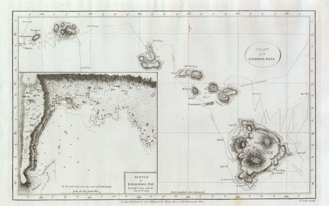
Subject: Hawaii

Period: 1784-86 (published)

Publication: New Authentic and Complete Collection of Voyages Round the World…

Color: Black & White

Size:
13.3 x 8.3 inches
33.8 x 21.1 cm
Download High Resolution Image
(or just click on image to launch the Zoom viewer)

This important early chart of the Hawaiian Islands is a slightly reduced version of the first printed map of Hawaii. It shows the path of the Resolution and the Discovery that tracks Cook's movements following his first visit to the Sandwich Islands in January 1778 and his return in November of the same year. The large inset depicts Kealakekua Bay where the great navigator met his untimely demise on February 14, 1779. Finely engraved by Thomas Conder.

References: cf Fitzpatrick pp.16-17.

Condition: A

Lovely condition, with a small spot in bottom border, else fine.

Estimate: $550 - $650

Sold for: $475

Closed on 6/2/2010

Archived