Catalog Archive
Auction 132, Lot 228

"Areal Geology of the Denver Basin [and] Preliminary Map of the Eastern Base of the Rocky Mountains Colorado…", U.S. Geographical Survey
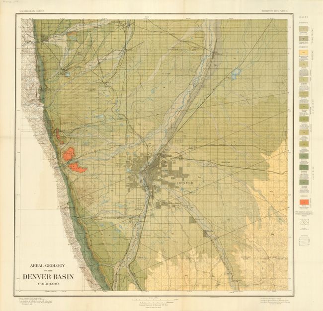
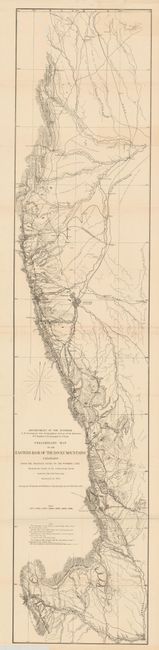
Subject: Colorado

Period: 1888 (circa)

Publication:

Color: Printed Color

Size:
20.5 x 20.5 inches
52.1 x 52.1 cm
Download High Resolution Image
(or just click on image to launch the Zoom viewer)

1) Areal Geology of the Denver Basin, by U.S. Geographical Survey, circa 1888, printed color (20.5 x 20.5). This interesting geological map on the vicinity of Denver covers from Boulder to Archer (now Chatfield State Park), and from Brighton to Parker. The map illustrates fifteen different geological formations keyed to a legend at right. The major streets of Denver and the suburbs are shown, along with highways, railroads and rivers. Fine condition (A+).

2) Preliminary Map of the Eastern Base of the Rocky Mountains Colorado from the Arkansas River to the Wyoming Line…, circa 1874, by F.V. Hayden, U.S. Geological and Geographical Survey, uncolored (10.3 x 48"). This maps presents a detailed view of the Front Range showing "the Limits of the Sedimentary Rocks and also the Coal Outcrops Surveyed In 1874." It also shows watershed, towns, roads and railroads. Printed on two sheets, as issued. There are some short fold separations and a fingernail size piece of paper loss near the Wyoming border. Otherwise it is clean with no toning, which is unusual for maps of this period (B).

References:

Condition:

Folding as issued. See descriptions.

Estimate: $220 - $275

Sold for: $150

Closed on 6/2/2010

Archived