Catalog Archive
Auction 132, Lot 207

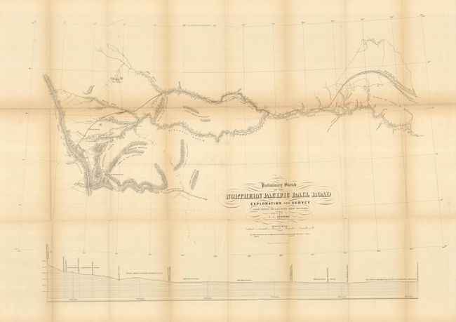
"Preliminary Sketch of the Northern Pacific Rail Road Exploration and Survey from Riviere des Lacs to the Rocky Mountains Made in 1853", Stevens, Isaac Ingalls

Subject: Northwestern United States

Period: 1855 (dated)

Publication: U.S. Pacific Railroad Surveys

Color: Black & White

Size:
32.5 x 21.5 inches
82.6 x 54.6 cm
Download High Resolution Image
(or just click on image to launch the Zoom viewer)

This map details the Stevens surveys beginning on the Missouri River at Fort Clark and culminating at the Continental Divide of the Rockies. The route travels along the Plateau of the Missouri to Fort Benton (Missoula) and on to the Continental Divide at Lewis and Clark Pass. Locates Hell's Gate Passes to the south. It is filled with many place names, forts, unexplored areas, etc. Mountain terrain indicated through fine hachuring and the lower portion of the sheet is a profile of the route. This large example is from the rare 8vo Pacific Railway atlas. Lithographed by the Philadelphia firm of Wagner & McGuigan.

References: Wheat (TMW) #862.

Condition: C+

The map is generally sound but there is a long fold split along the upper horizontal fold and the folds are toned. The map should be professionally backed to stabilize the paper.

Estimate: $80 - $100

Sold for: $60

Closed on 6/2/2010

Archived