Catalog Archive
Auction 132, Lot 200

"[Lot of 3 - Western U.S.]", Eastman, Seth (Capt)

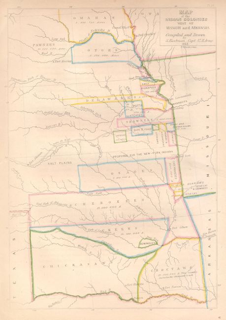
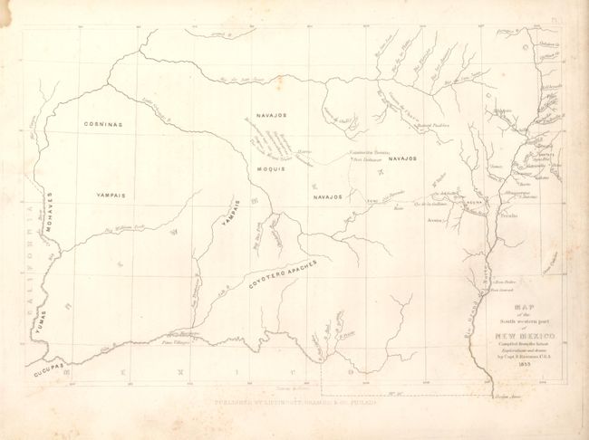
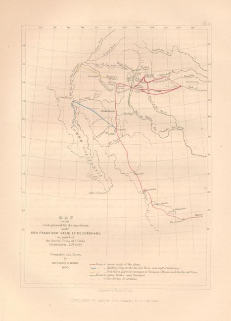
Subject: Western United States

Period: 1853 (dated)

Publication: Schoolcraft's Information Respecting the History... Indian Tribes…

Color:

Size:
See Description
Download High Resolution Image
(or just click on image to launch the Zoom viewer)

1)Map of the Indian Colonies West of Missouri and Arkansas, Seth Eastman, 1853, hand color, (7.8 x 11.3"). This interesting map locates the Indian tribes and reservations in the region of present-day Oklahoma, Kansas and Nebraska. Original hand coloring, very good with some edge toning in margins.

2)Map of the South western part of New Mexico, Seth Eastman, 1853, black & white, (11.4 x 7.6"). This map details the Indian Tribes throughout New Mexico Territory. Locates Navajos, Mouquis (Hopi), Cosninas, Mohaves, Yumas, Yampais and Coyotero Apaches. Locates Acoma, the Hopi mesas and the "Seven Moqui Towns," Laguna, Santa Fe, Taos and the Pima Villages in the location of the future Phoenix. Some light scattered foxing mostly at right and bottom margin (B).

3)Map of the route pursued by the expedition under Don Francisco Vasquez de Coronado in search of the Seven Cities of Cibola. Undertaken A.D.1540, Compiled by Richard H. Kern, hand color, (6.3 x 8.6"). The map features the various routes taken by the Coronado expedition in search of the legendary seven cities of Cibola. It extends from the western US to Mexico City. Slight offsetting, still very good.

References:

Condition:

See individual descriptions.

Estimate: $100 - $200

Sold for: $190

Closed on 6/2/2010

Archived