Catalog Archive
Auction 132, Lot 194

"[Lot of 3] Johnson's Minnesota and Dakota [and] Colton's Minnesota [and] Dakota",

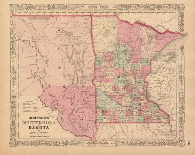
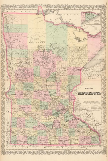
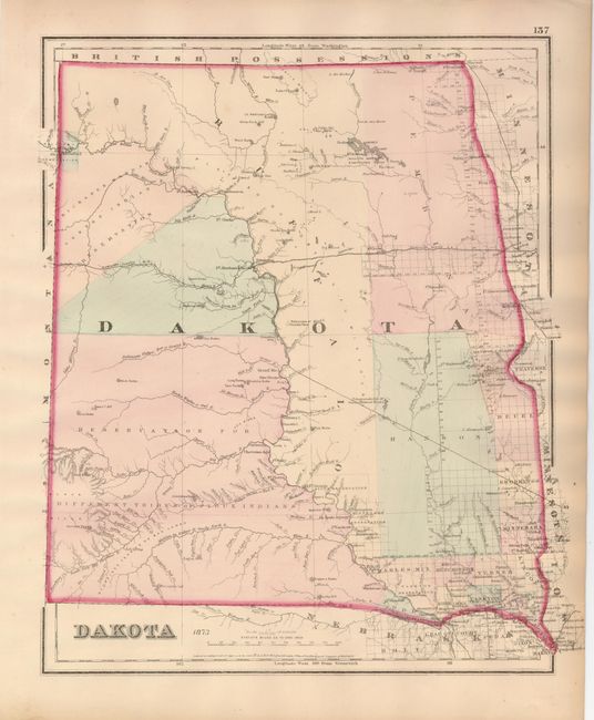
Subject: Midwestern United States, Minnesota and Dakotas

Period: 1864-73 (circa)

Publication:

Color: Hand Color

Size:
See Description
Download High Resolution Image
(or just click on image to launch the Zoom viewer)

This lot shows the rapid development of Minnesota and the Dakota during a ten year period. < br>
1) Johnson's Minnesota and Dakota, published in Johnson and Ward's New Illustrated Atlas, circa 1861 (15.6 x 12.5"). The newly formed Dakota Territory is a huge unorganized area with its western boundary just beyond the Missouri River. An interesting notation locates vast prairies said to be "the great Hunting and Fighting Ground of Dakotah, Odjebwe, Assiniboin, Arikara, Minitarree and other Nations." The proposed Northern route of the Pacific Railroad is shown crossing the Dakota wilderness. There is good detail throughout Minnesota, whose county development is already well developed except in the northern third of the state. Nice example with just a couple small spots at left above legend. < br>
2) Minnesota, published in G.W. & C.B. Colton's General Atlas, circa 1867 (16" x 23") This large, double-page map is filled with detail attesting to the rapid growth of the region during this period. It shows numerous railroads expanding north and west, cities, towns, watershed, forts, lakes, and more. The inset, "Continuation of the North East Portion of Minnesota" includes all of Cook County. Narrow, but adequate side margins with a little chipping. < br>
3) Dakota, by G.W. & C.B. Colton and published in Gray's Atlas of the United States, in 1873 (12.5 x 14.8"). This handsome map of the territory shows its boundaries now encompassing only the area that would become the states of North and South Dakota. There are just a few counties in the southeast and a huge Pembina County in the northeast. The western portion is labeled as land set-aside for various Indian tribes including Sioux, Arickaree [sic], Mandan, and Gros Venture Tribes. It is a great map of the region 16 years before statehood. Light toning in blank margins.

References:

Condition: A

Estimate: $300 - $400

Sold for: $200

Closed on 6/2/2010

Archived