Catalog Archive
Auction 132, Lot 193

"[Lot of 3] Map of Kansas, Nebraska and Colorado. Showing also the Eastern portion of Idaho [and] Nebraska, Kansas, Dakota Colorado and Montana [and] Wyoming, Nebraska, Kansas, Dakota Colorado and Montana", Mitchell, Samuel Augustus

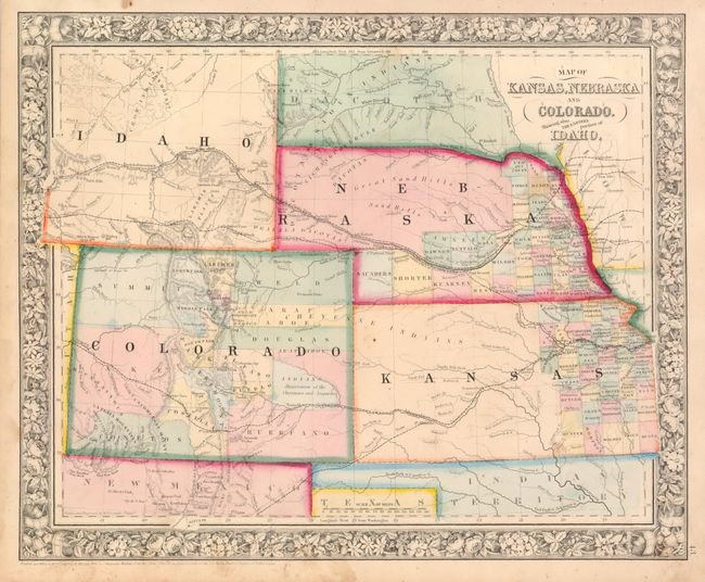
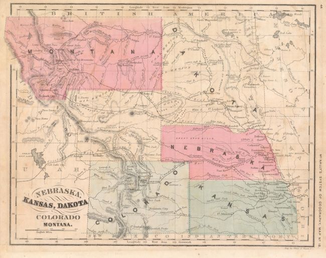
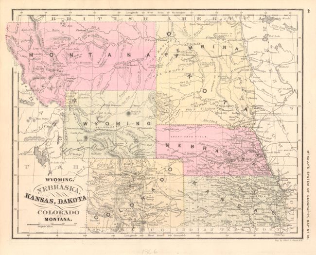
Subject: Midwestern United States and Rocky Mountain West

Period: 1863-75

Publication: General Atlas

Color: Hand Color

Size:
14.2 x 11.5 inches
36.1 x 29.2 cm
Download High Resolution Image
(or just click on image to launch the Zoom viewer)

These three maps provide a great view of the rapid development of this region following the Civil War.

1) Map of Kansas, Nebraska and Colorado. Showing also the Eastern portion of Idaho, from Samuel Augustus Mitchell's General Atlas, 1863 (14.2 x 11.5"). This map now shows Idaho Territory (modern Wyoming) extending to Dacotah Territory and Nebraska. The major emigrant wagon roads are prominently shown, as is the PONY EXPRESS route. Numerous Indian tribes, forts and trading posts are located. County development in Kansas and Nebraska is limited to the eastern region. Colorado now shows numerous early county configurations with a large Reservation of the Cheyennes and Arapaches in eastern Colorado. Some minor stains and soil in the blank margins and border (B+)

2) Nebraska, Kansas, Dakota Colorado and Montana, from Francis McNally's An Improved System of Geography, 1866 (10.3 x 8.4"). This simple map presents a surprisingly detailed view of the topography with wagon, mail and exploration routes, forts, towns, coal and oil regions, and Indian battle locations. The map show the newly organized Montana Territory, which left the region of modern Wyoming attached to Dakota. Among the many wagon roads shown is a completely spurious road across the Big Horn Mountains and what will become Yellowstone National Park. Faint, scattered foxing and a marginal tear repaired with archival tape (B+).

3) Wyoming, Nebraska, Kansas, Dakota Colorado and Montana, from Francis McNally's An Improved System of Geography, circa 1875 (10.3 x 8.4"). The is a great comparison with the previous map that shows not only the completed formation of Wyoming Territory and Yellowstone National Park, but also shows the rapid development throughout the region. Several railroads now serve the mining districts in Colorado and the agricultural regions of Nebraska and Kansas. This version varies slightly from the one mentioned by Blevins with Yellowstone National Park being confined completely in Wyoming and there being some additional place names (A+).

References: Blevins #163, #182, cf #381.

Condition:

See descriptions.

Estimate: $300 - $400

Sold for: $220

Closed on 6/2/2010

Archived