Catalog Archive
Auction 132, Lot 192

"Panorama of the Mississippi Valley and its Fortifications", Magnus, Charles

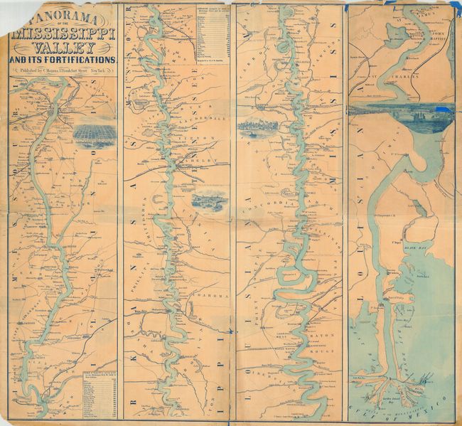
Subject: Central United States - Mississippi River

Period: 1863 (circa)

Publication:

Color: Hand Color

Size:
26 x 24 inches
66 x 61 cm
Download High Resolution Image
(or just click on image to launch the Zoom viewer)

This great Civil War map is in the strip-map style on four panels. The map shows the course of the Mississippi River from its confluence with the Missouri River south to its delta on the Gulf of Mexico. Excellent detail throughout locates towns and villages, forts, railroad lines, tributaries, and islands. Beside St. Louis, Memphis, Vicksburg, and New Orleans are finely rendered birds-eye views of the cities. The two distance tables include distances obtained by steamer. Blank verso.

References: Stephenson (CW) (2nd ed.) 42.5.

Condition: C

Due to this map's rarity we are offering a less than good example with the expectation the new owner will seek professional restoration of this important map. There are some tender fold lines, a little loss at some fold intersections and tears. Upper left corner is partially missing with small loss to the letter "P" on Panorama.

Estimate: $400 - $600

Unsold

Closed on 6/2/2010

Archived