Catalog Archive
Auction 132, Lot 178

"La Floride", Sanson, Nicolas

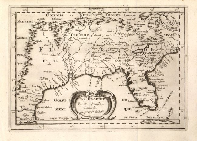
Subject: Colonial Southern United States

Period: 1682 (published)

Publication: Curieus Aenmerckingen der bysonderste Oost en West Indische

Color: Black & White

Size:
9.9 x 6.9 inches
25.1 x 17.5 cm
Download High Resolution Image
(or just click on image to launch the Zoom viewer)

This influential map shows the Spanish and French possessions in the southern part of the United States. The map extends from the southernmost part of Virginia to the coast of what is now Texas. When first introduced by Sanson in 1657, this map was the first to use the name L. Erie in an atlas and to introduce several new rivers in Virginia. The French claims in the Carolinas are reasserted with the region named Floride Francoise, despite the region not having had any French presence for nearly 100 years. The place name Caroline is not related to the future English colony of Carolina. Instead it is a confusion between the French Fort Caroline on the St. Johns River, and Charlefort that was located near Port Royal. This issue is from a re-engraved plate published by Joannes Ribbius and Simon de Vries.

References: Burden #326; Cumming (SE) #53.

Condition: A

Clean crisp impression.

Estimate: $650 - $750

Sold for: $650

Closed on 6/2/2010

Archived