Catalog Archive
Auction 132, Lot 174

"A New Map of Part of the United States of North America, containing the Carolinas and Georgia, also the Floridas and Part of the Bahama Islands &c. from the Latest Authorities", Cary, John

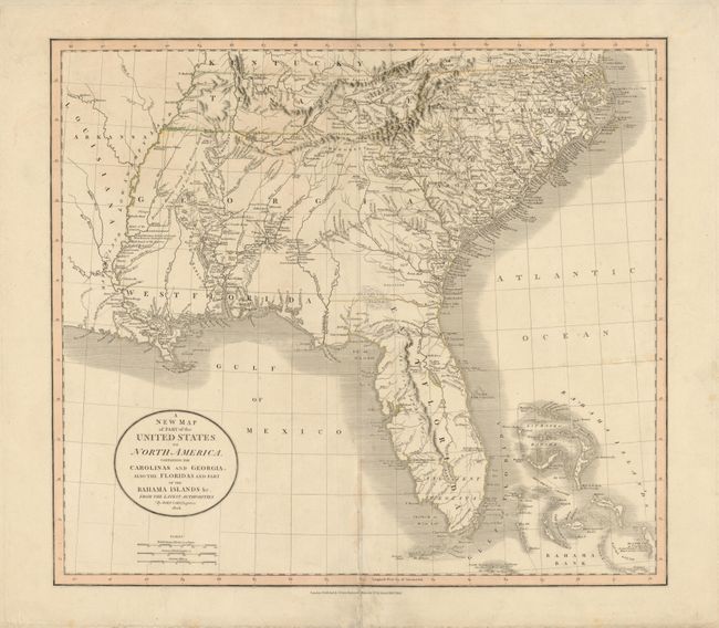
Subject: Southeast United States

Period: 1806 (dated)

Publication: New Universal Atlas

Color: Hand Color

Size:
20.3 x 18 inches
51.6 x 45.7 cm
Download High Resolution Image
(or just click on image to launch the Zoom viewer)

This is an early edition of this interesting map of the Southeast. It was issued during a period of rapid change and advancement in the young United States. East and West Florida exist as separate territories and Georgia extends to the Mississippi River. West Florida was not annexed into the United States until 1810. The map is filled with information on the roads, portages, forts, Indian villages, settlements and topography. It is also remarkable for the many interesting notes, including the Principal Hunting Grounds of the Western Party and Six Villages in Mississippi, here shown as part of the large Georgia Territory. In Florida, Fort St. Marks, Apalacha Fort, and the roads from St. Augustine are shown, with a note that the Apalachees Villages are now almost all deserted. Southern Florida is labeled Ancient Tegesta. A lake and river system connects Mayaco Lake (Lake Okeechobee) with the St. Johns River. The map extends to provide good detail of the Bahamas including a notation on Guanihani or Cat Island that it was the first Land of America Discovered by Columbus - a common misconception of the period.

References:

Condition: B

There is some damp stain along the lower centerfold, which has been repaired and the color is slightly faded.

Estimate: $900 - $1,000

Unsold

Closed on 6/2/2010

Archived