Catalog Archive
Auction 132, Lot 134

"Map of the United States of America, Showing the Rail Roads. To Illustrate Harpers Gazetteer", Smith, J. Calvin

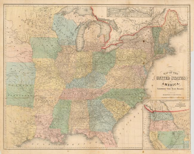
Subject: United States

Period: 1855 (dated)

Publication: Harpers Gazetteer

Color: Hand Color

Size:
27 x 21 inches
68.6 x 53.3 cm
Download High Resolution Image
(or just click on image to launch the Zoom viewer)

The main map covers the eastern part of the United States and a large inset shows the West. The boundaries of Washington and Oregon reach the Rocky Mountains, Utah includes Nevada and part of Colorado, New Mexico includes Arizona, and a huge Nebraska covers the rest of the West. The Indian Territory is here called Western Territory. An inset at top depicts railroad and canal routes from Albany to Buffalo. A table of explanations identifies markings for state capitals, towns, villages, railroads, canals and stage roads.

References:

Condition: B

Issued folding, now flattened. Original color and margins on thin paper Some scattered foxing spots and toning, long binding side tear closed on verso and some other splits closed on verso, one small worm hole in Georgia not affecting any printing. Shows better than suggested by the noted flaws.

Estimate: $150 - $200

Sold for: $90

Closed on 6/2/2010

Archived