Catalog Archive
Auction 132, Lot 119

"British Dominions in America, Drawn from the latest and best Authorities", Kitchin, Thomas

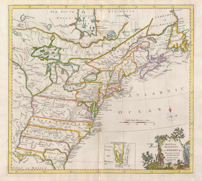
Subject: Colonial United States and Canada

Period: 1771 (circa)

Publication:

Color: Hand Color

Size:
14.7 x 13.3 inches
37.3 x 33.8 cm
Download High Resolution Image
(or just click on image to launch the Zoom viewer)

This handsome colonial period map covers the area east of the Mississippi River and from James Bay to the Gulf of Mexico. It shows the provinces and colonies, towns and cities, Indian villages and tribal territory, forts and other points of interest. The British Colonies extend to the Mississippi River and include the Canadian Province of Quebec, Nova Scotia, Labrador and Newfoundland; thus relegating the French colonies to the frontier. Florida is divided into two provinces with the northern boundary of East Florida extending north of the 31° parallel, reflecting a long boundary dispute between Britain and Spain. The southern tip of Florida is presented as a group of large islands and is shown in an inset. The map was prepared for William Guthrie's New Geographical Grammer [1770-71] and A New System of Modern Geography [1780-2].

References: McCorkle #780.6; Goss (NA) #64.

Condition: B+

Nice impression with faint toning along the centerfold.

Estimate: $475 - $550

Sold for: $650

Closed on 6/2/2010

Archived