Catalog Archive
Auction 131, Lot 680

"Neu und Accurat Versaste General Post Landkarte … Hungarn", Lidl, Johann Jacob

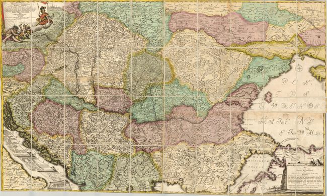
Subject: Southeastern Europe, Hungary

Period: 1740 (circa)

Publication:

Color: Hand Color

Size:
50 x 30 inches
127 x 76.2 cm
Download High Resolution Image
(or just click on image to launch the Zoom viewer)

This is an extremely rare chart showing the postal roads throughout the southeastern part of Europe. The map covers from the eastern part of the Czech Republic (Olomouc and Brno) to Ukraine and the Crimea in the north, and from the Adriatic to Istanbul in the south. The map is filled with information keyed to an extensive table engraved onto a scroll in the Adriatic. A dedication to the count of Harrach is contained in a decorative cartouche at upper left and the title is engraved onto a monument-style cartouche in the opposite corner. The map is dissected and mounted on linen and folds into the original paper-covered slipcase. Johann Jacob Lidl is a little known Austrian publisher. His postal charts are his most important works. This chart does not appear to have ever been on the market and there are only 3 other references to his work in 25 years of dealer and auction records.

References:

Condition: A

Sharp impression and original color. There is some very faint toning, but overall near fine - especially for such a rare and important map. The slipcase is rubbed, but full intact.

Estimate: $1,600 - $2,200

Sold for: $1,800

Closed on 3/17/2010

Archived