Catalog Archive
Auction 130, Lot 92

"North & South America; for the Elucidation of the Abbe Gaultier's Geographical Games", Aspin, Jehoshaphat

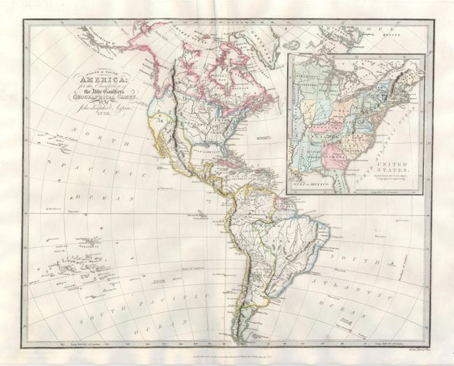
Subject: Western Hemisphere

Period: 1826 (dated)

Publication:

Color: Hand Color

Size:
16.8 x 13.5 inches
42.7 x 34.3 cm
Download High Resolution Image
(or just click on image to launch the Zoom viewer)

This is a very unusual and interesting map with a large inset of the United States. The Western Hemisphere map presents an odd border between Mexico and the United States, and the British perspective for the boundary with Canada. The large inset shows the United States, which extends to just beyond the Mississippi River. This inset locates and names Franklinia shown in western Tennessee and Kentucky. In 1785, settlers in western North Carolina and what would become eastern Tennessee organized a state government to be named in honor of Benjamin Franklin. Congress turned down their appeal but the state maintained a legislature and governor until 1788. This ephemeral state appears on only a small number of maps and this is a late appearance of this frontier political experiment. This scarce map was not included in Baynton-Williams' Map Collector article "Maps marking the American State of Franklin," (TMC-72, pp12).

References:

Condition: A+

Clean, bright paper, nice impression and color, and original margins.

Estimate: $400 - $500

Sold for: $500

Closed on 12/2/2009

Archived