Catalog Archive
Auction 130, Lot 687

"[Lot of 3] Persia [and] Persia with part of the Ottoman Empire, by G. Long [and] The Eastern Part of the Ancient Persian Empire, by G. Long",

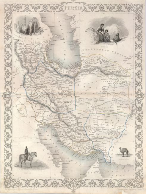
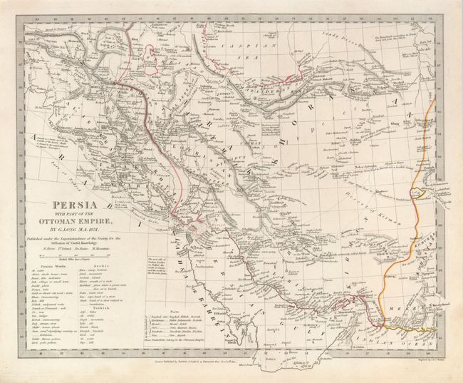
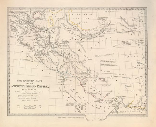
Subject: Persia - Iran

Period: 1831-1850 (published)

Publication:

Color: Hand Color

Size:
See Description
Download High Resolution Image
(or just click on image to launch the Zoom viewer)

The first map is by J. Tallis, (9.8 x 13.3") outline color, tear at lower margin repaired with small loss outside of map border. From the Illustrated Atlas, one of the last decorative atlases produced. This lovely steel engraving of the region includes Iran, Iraq, the Persian Gulf, Sea of Oman, and most of the Caspian Sea. Names Russia and the Independent Tartary. Vignettes surround depicting a horse-mounted Persian, Isphan, Kurds, and a Bactrian Camel. A decorative border surrounds the map. The illustrations are by H. Warren, engraved by S. Fisher and the map was drawn and engraved by J. Rapkin. The vignettes and border are uncolored, as issued. Close margins, as issued and some toning along centerfold (B).

The last two maps use the same base SDUK map, and includes all or parts of Iran, Iraq, UAE, Oman, Bahrain, Saudi Arabia, etc. The first shows the modern (1831) Ottoman Empire configuration, locating the cities of Babylon, Bosrah, Shiraz, Isphan, Tehran, and many more. A table translates Persian, Arabic and Turkish words to English. The latter describes the ancient empire of Persia, locating the cities of Nisibis, Siazuros, Ctesiphon & Koche, Babylon, Alexandria, Forath, Agbatana or Ecbatna, and many more. Both are dated 1831, measure 14.3 x 11.5" and have original outline color. Both are fine (A+).

References:

Condition:

See individual descriptions.

Estimate: $140 - $180

Sold for: $80

Closed on 12/2/2009

Archived