Catalog Archive
Auction 130, Lot 431

"The Extended Road from Oakham to Richmond in Yorkshire … to Barnsley", Ogilby, John
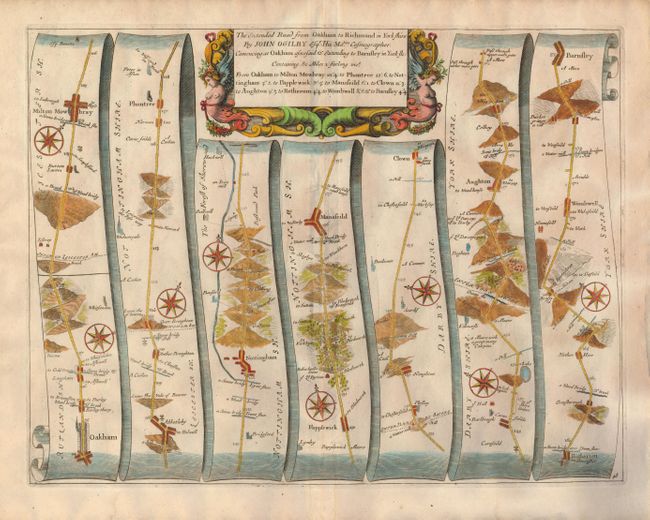
Subject: England

Period: 1675-79 (published)

Publication: Britannia: or the Kingdom of England and Dominion of Wales…

Color: Hand Color

Size:
17 x 13 inches
43.2 x 33 cm
Download High Resolution Image
(or just click on image to launch the Zoom viewer)

Handsome copper engraved road map in the pictorial style as pioneered by Ogilby with the roads laid out in several ribbon-like panels. The map begins in Oakham at milepost 94 and continues in a mostly northerly direction to Milton Mowbray and onward to Abketleby, the Vale of Beaver, Plumtree, Nottingham, Mansfeild, Scardif, Clown, Aughton, Wombwell, and Barnfley. North of Nottingham the Gallowes are located. The area of Robin hood is noted north of Papplewick as "Robin hoods Stone ye Sd. Byrons." Locates via icons and hand coloring churches, fords, bridges, small villages, topography and cross-roads with destination noted. Each of the six panels has a decorative compass rose to orient the traveler. The title cartouche is in a strapwork and garland style. Blank verso.

References:

Condition: A

Full margins and good impression on hand laid paper with small watermark. Page "48" at lower right.

Estimate: $300 - $350

Sold for: $300

Closed on 12/2/2009

Archived