Catalog Archive
Auction 130, Lot 368

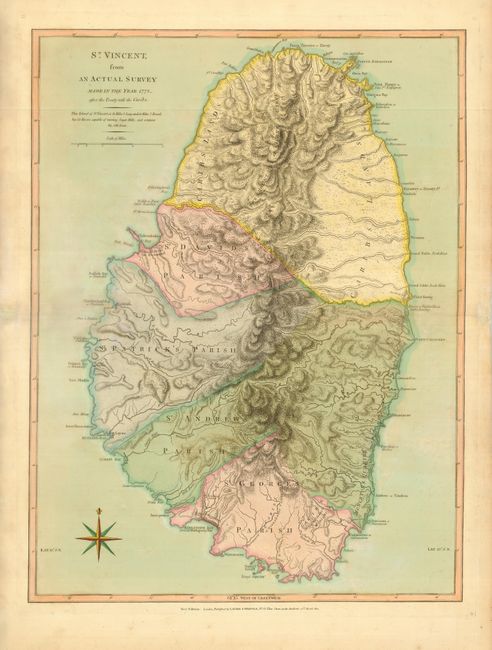
"St. Vincent from an Actual Survey Made in the Year 1773 after the Treaty with the Caribs", Jefferys/Laurie & Whittle
Subject: St. Vincent

Period: 1810 (dated)

Publication: A New and Elegant Sheet Atlas…

Color: Hand Color

Size:
18.3 x 24.3 inches
46.5 x 61.7 cm
Download High Resolution Image
(or just click on image to launch the Zoom viewer)

The treaty to which the title refers was short-lived and it was not until 1797 that Carib resistance was finally crushed. The island was an important part of the British presence in the Caribbean due to sugar production. A note below the title explains, "This Island of St. Vincent is 18 miles 1/8 long, and 11 miles 1/5 broad, has 22 rivers capable of turning sugar mills, and contains 84,286 acres". The map illustrates the important rivers and shows the four parishes. The northern part of the island is noted as Caribs Lands where the Morne a Garou mountains dominate the topography.

References:

Condition: B+

Fine original color with a faint damp stain at left and fold separations repaired in the blank margins.

Estimate: $500 - $600

Unsold

Closed on 12/2/2009

Archived