Catalog Archive
Auction 130, Lot 309

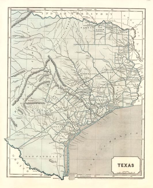
"Texas", Morse & Breese

Subject: Texas

Period: 1844 (dated)

Publication: Morse's North American Atlas

Color: Printed Color

Size:
12.5 x 15 inches
31.8 x 38.1 cm
Download High Resolution Image
(or just click on image to launch the Zoom viewer)

This scarce, desirable map of the Independent Republic of Texas extends north to above the Red River to the Old Wichita Village, and west to the Presidio Rio Grande and the Rio Colorado at about 101° West. It is an early example of the cerographic engraving process, and was originally issued as a loose supplement, later bound into Morse's atlas. The map locates early land grants, counties, towns and missions, wagon roads, watershed, forts, and many other details. Blank verso.

References: Day #110.

Condition: A+

Full margins and dark impression.

Estimate: $550 - $650

Sold for: $600

Closed on 12/2/2009

Archived