Catalog Archive
Auction 130, Lot 292

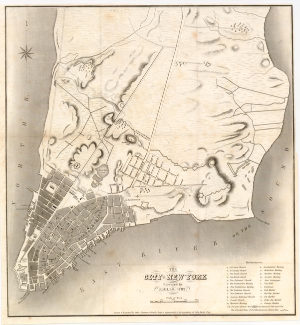
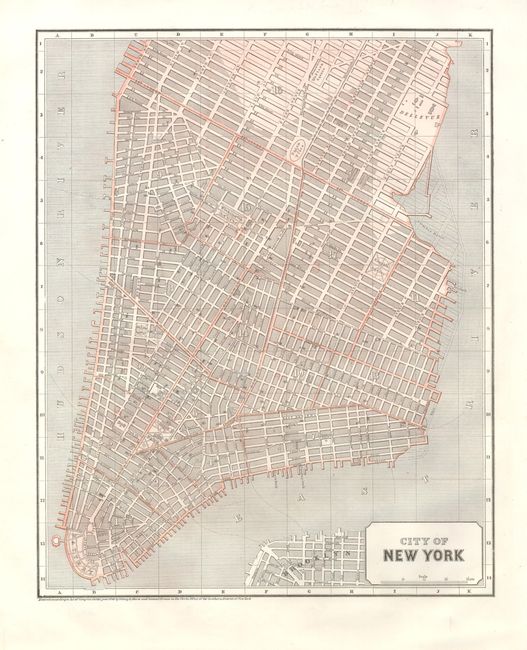
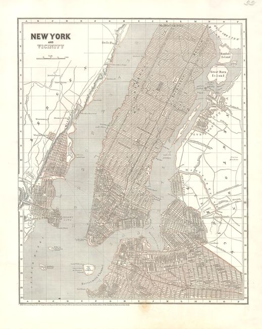
"[Lot of 3] The City of New York Surveyed by J. Hills, 1782 [and] City of New York [and] New York and Vicinity",

Subject: New York City

Period: 1782-1844 (published)

Publication:

Color:

Size:
See Description
Download High Resolution Image
(or just click on image to launch the Zoom viewer)

This lot consists of three maps of New York City. The first is an 1840 reprint by Stiles, Sherman & Smith, New York, 11.7 x 12.5", uncolored. It is a detailed map of lower Manhattan as it appeared in 1782 and as surveyed by J. Hills. Streets are named, major public buildings are located and fortifications in the wilderness to the north are shown adjacent to Bunker Hill. Just outside of the city is the "Jew Burial Ground," Powder House, and a fortified hospital. In the lower right is a reference index for 25 for public places, a legend showing the burnt areas of 1776 & 1778, and "the principal lines of Fortifications." Fully ruled lines in the water. A few minor foxing spots and narrow margins. (B+)

The next two maps were printed by Morse & Breese, 1844, 12" x 15", printed color. Both are early examples of printed color using the cerographic process as published in Morse's North American Atlas . The first covers lower Manhattan in great detail up to above 28th Street to include Madison Square. Fine. (A+) The last map takes a wider view of the city to include parts of Brooklyn, Ravenwood, Astoria, and Jersey City. It includes Governor's (or Nutten) Island, Ellis Island, and Bedloe's Island and extends up the Hudson River to Bulls Ferry. The map is fine less a 1/2" light soiled circle in the lower margin touching the border. (B+)

References:

Condition:

See individual descriptions.

Estimate: $250 - $350

Sold for: $160

Closed on 12/2/2009

Archived