Catalog Archive
Auction 130, Lot 23

"Nova Totius Terrarum Orbis Geographica ac Hydpographica Tabula", Hondius/Mariette
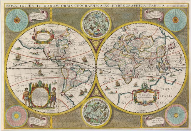
Subject: World

Period: 1642 (dated)

Publication: Theatre Geographique de France

Color: Hand Color

Size:
22 x 15 inches
55.9 x 38.1 cm
Download High Resolution Image
(or just click on image to launch the Zoom viewer)

The Hondius world map of 1617 was the prototype for a series of maps by French publishers who combined Hondius' geographical information with the more scientific border decorations from Boisseau's map of 1636. The map depicts the discovery of the Le Maire Strait at the tip of South America. In North America, the St. Lawrence River runs nearly the entire width of the continent, terminating in a large lake not far from the infamous Civolo 7 citta (7 cities of Cibola). Hudson Bay is depicted after the work of Gerritsz. In Asia, Korea is shown as an island, the northern coast of New Guinea is more properly located and there is a large Terre Australle Incognue with Boach named in the region of the Australian continent. The surrounding engravings include a pair of celestial charts, circular diagrams containing the compass points, the names of the winds, the climatic zones, the heavenly orbits and a thirty-year calendar. The map is richly adorned with a variety of decorations including three cartouches, each with figures, numerous sailing ships, sea monsters, flying fish and a depiction of Neptune. This is the first state with Mariette's imprint.

References: Shirley #358.

Condition: B+

Issued folded, now flattened and professionally backed with Japanese tissue with some paper replacement in the narrow margins. There is faint toning on a couple of folds.

Estimate: $5,500 - $6,500

Sold for: $4,250

Closed on 12/2/2009

Archived