Catalog Archive
Auction 130, Lot 187

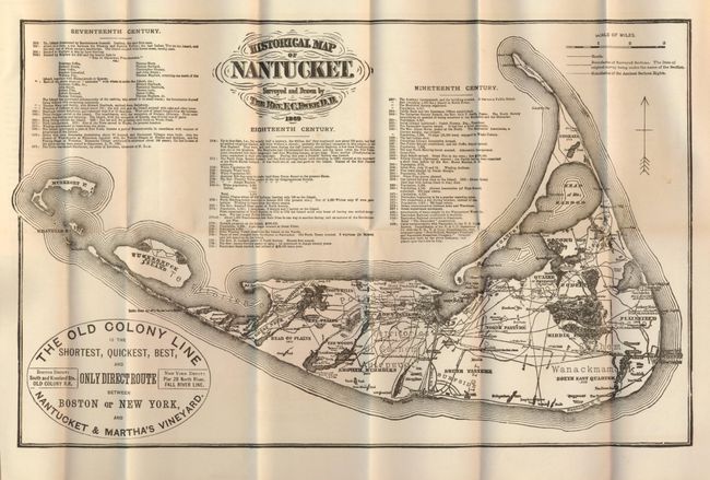
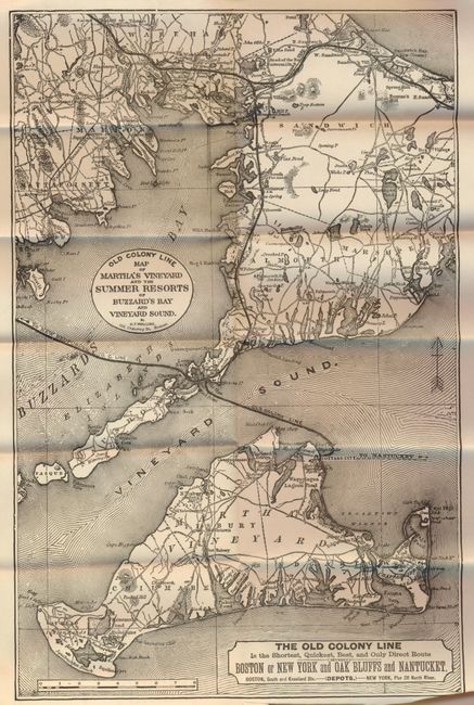
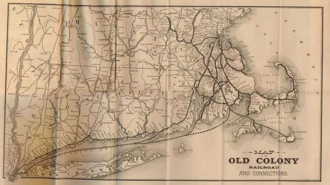
"[Lot of 3] Historical Map of Nantucket. Surveyed and Drawn by the Rev. F.C. Ewer D.D., 1869 [with two additional maps]",

Subject: New England

Period: 1893 (dated)

Publication:

Color: Black & White

Size:
13.3 x 8.5 inches
33.8 x 21.6 cm
Download High Resolution Image
(or just click on image to launch the Zoom viewer)

This folding ephemeral pocket map extends to show Muskeget and the Huckernuck islands. It advertises "The Old Colony Line is the Shortest, Quickest, Best, and Only Direct Route between Boston or New York, and Nantucket & Martha's Vineyard." The map is a reproduction of the one surveyed and drawn by the Rev. F.C. Ewer in 1869 and shows roads, villages and the boundaries of the Ancient Sachem Rights. It also includes a chronology of historical events from 1602 to 1885. Bound in the original Tourists' Guide to Down the Harbor, Hull and Nantasket, Downer Landing, Hingham, Cohasset, Marshfield, Scituate, Duxbury, ‘The Famous Jerusalem Road’, ‘Historic Plymouth’, Cottage City, Martha’s Vineyard, Nantucket, Newport, R. I., and the Summer Resorts of Cape Cod and the South Shore of Massachusetts”, The Old Colony Newsroom Edition, Boston: published by John F. Murphy, 1893, 5-3/4" x 4". In original orange wrappers, 24mo, 103, [1] pp. including numerous text illustrations plus 3 folding maps.

The other folding maps are the Old Colony Line Map of Martha's Vineyard and Summer Resorts, (9 x 14"). This map shows the island in good detail with the route of the Old Colony Line shown prominently. On verso is promotional information on the area including an article "The Famous Sea-Side Resorts of America. Oak Bluffs, Martha's Vineyard, Nantucket, Cape Cod." Also timetable for Express Trains, plus marketing words like "The Only Direct Route between New York and Oak Bluffs…" Fine condition. (A+). The third map is Old Colony Railroad and Connections, (17.3 x 9.5"). It includes Connecticut, Rhode Island and Massachusetts. Railway is shown with bold dark line with all stations named. (A)

References:

Condition: A

Map is fine less a very short binding trim tear. Booklet's covers with a couple spots, contents generally fine or very good.

Estimate: $325 - $400

Sold for: $300

Closed on 12/2/2009

Archived