Catalog Archive
Auction 130, Lot 135

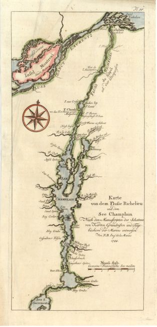
"Karte von dem Flusse Richelieu und dem See Champlain…", Bellin, Jacques Nicolas
Subject: Colonial United States and Canada

Period: 1744 (dated)

Publication:

Color: Hand Color

Size:
5.2 x 11.8 inches
13.2 x 30 cm
Download High Resolution Image
(or just click on image to launch the Zoom viewer)

Montreal and Lake Champlain, including the rivers Richelieu and St. Lawrence, are the focus of this detailed little chart. Montreal is here called Saint Maria. Lake Champlain was the major transportation route between the Saint Lawrence and Hudson valley during the colonial period. The French forts Chambly, l'Assomption, Richelieu and St. Frederic (Crown Point) attest to the importance of the region.

References:

Condition: B+

A 5" binding tear at left is well repaired with paper on verso and the binding trim at lower left has been replaced.

Estimate: $160 - $200

Sold for: $140

Closed on 12/2/2009

Archived