Catalog Archive
Auction 130, Lot 125

"Carte de l'Acadie et Pais Voisins…", Bellin, Jacques Nicolas
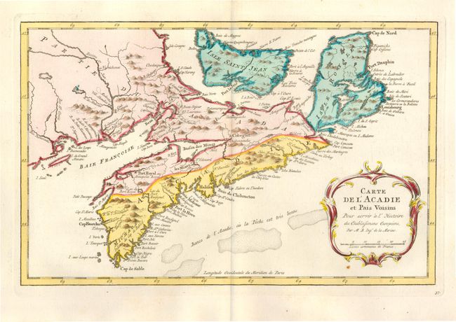
Subject: Canada

Period: 1773 (published)

Publication: Raynal's Atlas Portatif…

Color: Hand Color

Size:
12.6 x 8.1 inches
32 x 20.6 cm
Download High Resolution Image
(or just click on image to launch the Zoom viewer)

This map covers all of Nova Scotia including Cape Breton with Prince Edward Island (Isle Saint Jean) shown in good detail. The Micmac tribe is located near Shelburne. The southeastern part of Nova Scotia is named Acadie. South of Nova Scotia numerous banks are noted, where 'la Pesche est tres bonne' (the fish are very good). A decorative rococo-style cartouche fills the lower right corner of the map.

References: Kershaw #785.

Condition: A+

Sharp impression, original color and wide original margins. There is minor toning at paper edges.

Estimate: $160 - $200

Sold for: $130

Closed on 12/2/2009

Archived