Catalog Archive
Auction 129, Lot 820

"Carte de l'Egypte de la Nubie de l'Abissinie &c.", Delisle/Elwe
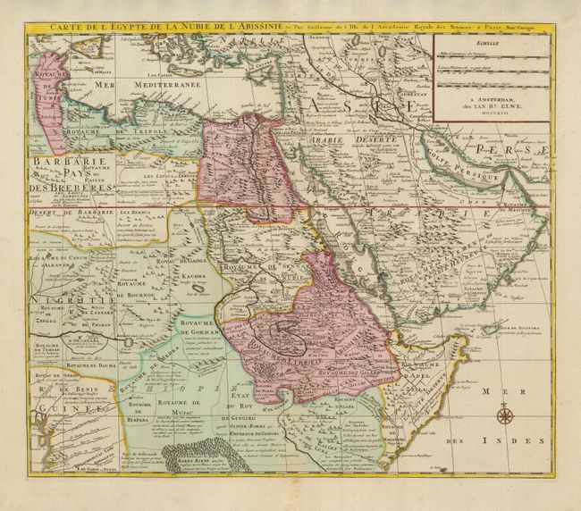
Subject: Northeastern Africa and Arabia

Period: 1792 (dated)

Publication: Atlas Geographique et Universel

Color: Hand Color

Size:
22 x 19 inches
55.9 x 48.3 cm
Download High Resolution Image
(or just click on image to launch the Zoom viewer)

This very detailed and fascinating map of northeastern Africa, the Red Sea and the Arabian peninsula shows the political divisions and kingdoms, roads, topography, settlements, encampments and much more. The Nile originates in the mountains near the L. de Dambee. The map is filled with notations concerning the various tribes, trade routes, etc.; one locates many emeralds can be found. The map is copied directly from Delisle map of the same title.

References:

Condition: A

Nice impression and original color with minor toning on lower centerfold, with an old paper repair in bottom margins.

Estimate: $450 - $550

Sold for: $250

Closed on 9/23/2009

Archived