Catalog Archive
Auction 129, Lot 69

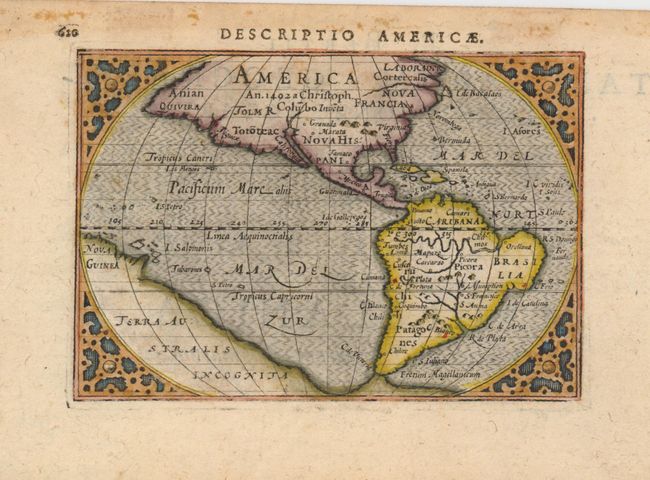
"Descriptio Americae", Bertius/Claesz

Subject: Western Hemisphere

Period: 1602 (published)

Publication: Tabularum Geographicarum Contractarum

Color: Hand Color

Size:
4.8 x 3.3 inches
12.2 x 8.4 cm
Download High Resolution Image
(or just click on image to launch the Zoom viewer)

First state of this charming miniature map based on the 1587 folio map by Abraham Ortelius. A notation in North America notes its discovery by Christopher Columbus in 1492. The only place names in North America, Norombega, Granada, and Marata, are all mythical. This map has a convoluted publishing history and it has been attributed to both Cornelis Claesz and Petrus Bertius. It made its appearance in a number of works starting with Claesz' work criticizing the Spanish for their treatment of the Indians. It then appeared in Bertius' revision of Langenes' pocket atlas. Claesz was the publisher for both these works. The title appears above the top border. The title page of the atlas is printed on verso.

References: Burden #92; King (2nd ed) pp. 80-82.

Condition: A

Some minor tape stains on verso, and light toning in blank margins.

Estimate: $325 - $400

Sold for: $350

Closed on 9/23/2009

Archived