Catalog Archive
Auction 129, Lot 688

"Pianta Topografica di Roma Antica con I Principali Monumenti…", Canina, Luigi

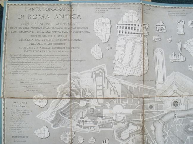
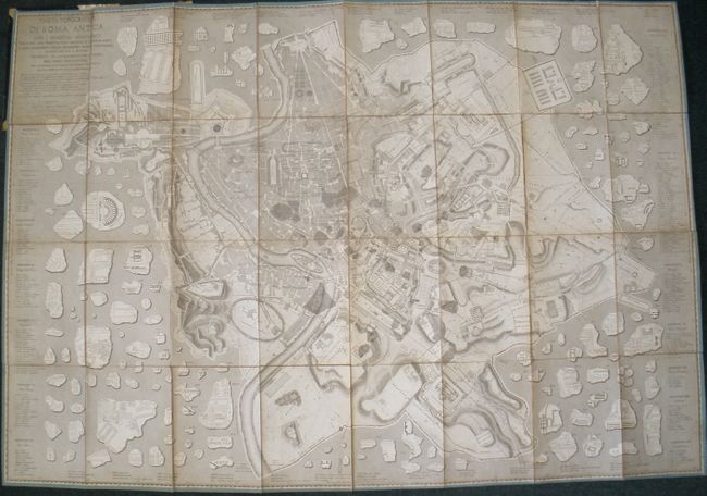
Subject: Rome, Italy

Period: 1850 (dated)

Publication:

Color: Black & White

Size:
54.5 x 37.8 inches
138.4 x 96 cm
Download High Resolution Image
(or just click on image to launch the Zoom viewer)

A very unusual, large-scale map of the archeological ruins in Rome by Luigi Canina, an Italian architect and archeologist, whose work provides an important view of the condition of the city and ancient artifacts in the mid-nineteenth century. The interesting plan depicts the ancient monuments overlaid on a base map of the modern city. Dissected and linen-backed with blue paper on edge, and folding into original, paper-covered boards.

References:

Condition: B+

Minor soil on map. The folds have been reinforced with linen, which has resulted in the map not completely fitting into the original covers.

Estimate: $600 - $700

Sold for: $450

Closed on 9/23/2009

Archived