Catalog Archive
Auction 129, Lot 670

"A Mapp of Italy Whose Cheife Estates & Isles are ye Dukedome of Toscania…", Blome, Richard
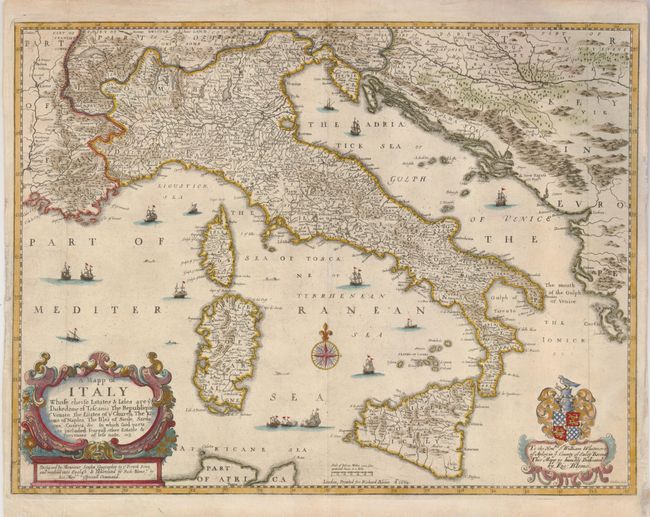
Subject: Italy

Period: 1669 (circa)

Publication:

Color: Hand Color

Size:
16 x 12 inches
40.6 x 30.5 cm
Download High Resolution Image
(or just click on image to launch the Zoom viewer)

Handsome, beautifully detailed map of all Italy, Corsica, Sardinia and the Dalmatian coast. The sea is filled with ships and sea monsters. Richard Blome was one of the most interesting and most active publishers of illustrated books in post-Restoration London. Blome's maps are important in British cartographic history because his atlases were completely produced in England. There was not a fully developed domestic mapmaking industry at the time, and most English publishers (including John Speed) had their plates engraved and/or printed on the continent. This map was engraved by Wenceslas Hollar. It was common practice during this period to finance publishing projects by soliciting sponsorship from wealthy patrons and dedicating maps to these sponsors. Blome took the practice to the extreme by selling the sponsorships yet again for subsequent editions. Thus, many of Blome's maps are known in several different states, with the change being a new dedication. This map is dedicated to Sir William Whitmore of Apley, Sheriff of Salop.

References:

Condition: A

There are some minor repairs and paper restoration in the blank margins.

Estimate: $375 - $450

Sold for: $600

Closed on 9/23/2009

Archived