Catalog Archive
Auction 129, Lot 437

"Exquisita & Magno aliquot mensium Periculo Lustrata etiam Retecta Freti Magellanica Facies…", Mercator, Gerard

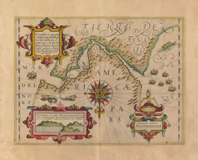
Subject: Southern South America

Period: 1613 (published)

Publication: Mercator Atlas

Color: Hand Color

Size:
18 x 13.5 inches
45.7 x 34.3 cm
Download High Resolution Image
(or just click on image to launch the Zoom viewer)

This exquisite map of the Strait of Magellan predates the discovery of the Straits of Le Maire. It details soundings and navigational hazards in this strategic waterway. The geographic details for this map were drawn from Bernardus Joannis Monasteriensis who accompanied the first Dutch expedition to sail through the Strait in 1599-1600. That expedition is portrayed on the map by the fleet of six sailing ships in the Mar del Zur. The map is one of the most beautifully embellished maps of the Mercator Atlas. It is centered on an elaborate compass rose orienting the map with north at the bottom. There are three large strapwork cartouches: penguins flank the title, a navigational compass is incorporated into the distance scale, and an inset with coastal view of the entrance to the strait fills the last cartouche. Whimsical sea lions, a whale and ships complete the composition. French text on verso.

References:

Condition: B+

Lightly toned with superb old color. There is an old repair on the bottom fold separation that just touches the map border.

Estimate: $900 - $1,200

Sold for: $650

Closed on 9/23/2009

Archived