Catalog Archive
Auction 129, Lot 22

"Europa Poly Glotta… [together with] Asia Poly-Glotta… [and] America cum Supplementis Poly-Glottis [and] Africa Poly-Glotta", Homann Heirs
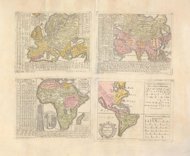
Subject: Continents

Period: 1741 (published)

Publication: Synopsis universae philologiae

Color: Hand Color

Size:
17.5 x 15.3 inches
44.5 x 38.9 cm
Download High Resolution Image
(or just click on image to launch the Zoom viewer)

This is a fascinating set of four separate thematic maps of the continents (each measuring approximately 7.7 x 6") on two joined sheets. Each map identifies the different countries and linguistic divisions, with tables displaying their script, alphabets and spoken languages. Important in the history of thematic mapping, this is one of the first to use color to distinguish areas and subjects on a theme. A Latin key in the lower right of the Africa map describes the colors used to show the habitation of descendants of Ham, Japheth and Shem after the Flood. The American map depicts California as an island, and oddly includes what appears to be Persian and Indian alphabets in panels to the right. Drawn by Gottfried Hensel and engraved by S. Dorn.

References: McLaughlin #229; Robinson, pp 55-56, and 130-132.

Condition: B+

On a sheet of thick hand laid paper with huge margins. A little light scattered foxing and tear at top professionally closed, otherwise fine.

Estimate: $950 - $1,100

Sold for: $850

Closed on 9/23/2009

Archived