Catalog Archive
Auction 128, Lot 894

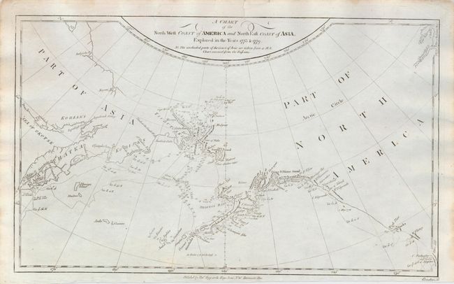
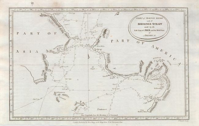
"[Lot of 2] A Chart of the North West Coast of America and the North East Coast of Asia, Explored in the Years 1778 & 1779 [and] Chart of Norton Sound and of Bherings Strait made by the East Cape of Asia and the West Point of America", Hogg, Alexander

Subject: North Pacific Ocean

Period: 1786 (published)

Publication: A New Authentic and Complete Collection of Voyages Round the World

Color: Black & White

Size:
13.8 x 8.5 inches
35.1 x 21.6 cm
Download High Resolution Image
(or just click on image to launch the Zoom viewer)

This lot is composed of two charts from Capt. Cook's voyages to the Bering Strait region. The first chart (13.8 x 8.5") was drawn by Lt. Roberts, Master mate on the Resolution under Cook. It depicts the coastlines of Alaska, British Columbia, and Russia; a note explains that part of the information on the map was obtained from a manuscript chart received from the Russians. The second chart (12.8 x 8") covers the area on either side of the Bering Strait including Norton Sound with the ship's route detailed with day-to-day notations during Cook's voyage in 1779. Details include sections of the coastline and islands with many place names, soundings and anchorages. Both were engraved by Thomas Conder.

References:

Condition: A

The first has a light impression. Both are near fine in their images but with edge toning and a few short marginal tears.

Estimate: $230 - $275

Sold for: $180

Closed on 5/20/2009

Archived