Catalog Archive
Auction 128, Lot 5

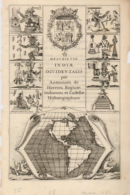
"Descriptio Indiae Occidentalis per Antonium de Herrera Regium Indiarum et Castellae Historiographum", Herrera y Tordesillas, Antonio de

Subject: Title Pages, America, California

Period: 1622 (published)

Publication:

Color: Black & White

Size:
6.5 x 10 inches
16.5 x 25.4 cm
Download High Resolution Image
(or just click on image to launch the Zoom viewer)

This important, and very scarce, title page includes the earliest representation of California as an Island. The small map of the Americas is presented on a trapezoidal projection in simple format with no place names or any interior geographical information. A prominent Northwest Passage adds further interest to the map. It apparently is a copy of the one accompanying Friar Antonio de la Ascension's report to the Council of the Indies and the King of Spain, October1620. That map was stolen by the Dutch from a Spanish vessel, thus beginning the theory of California's insularity that lasted more than a century. Eight vignettes of Aztec gods and ceremonies flank the title with a Castilian coat-of-arms at its center, and natives in dugout canoes flank the map. This is the first Latin edition, published by Michael Colijn (McLaughlin state 2).

References: Burden #195; McLaughlin #TP-1.

Condition: A

Sharp impression with some tears in blank margins, not affecting image.

Estimate: $2,200 - $2,750

Sold for: $2,300

Closed on 5/20/2009

Archived