Catalog Archive
Auction 128, Lot 260

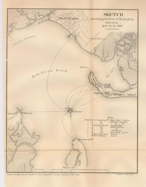
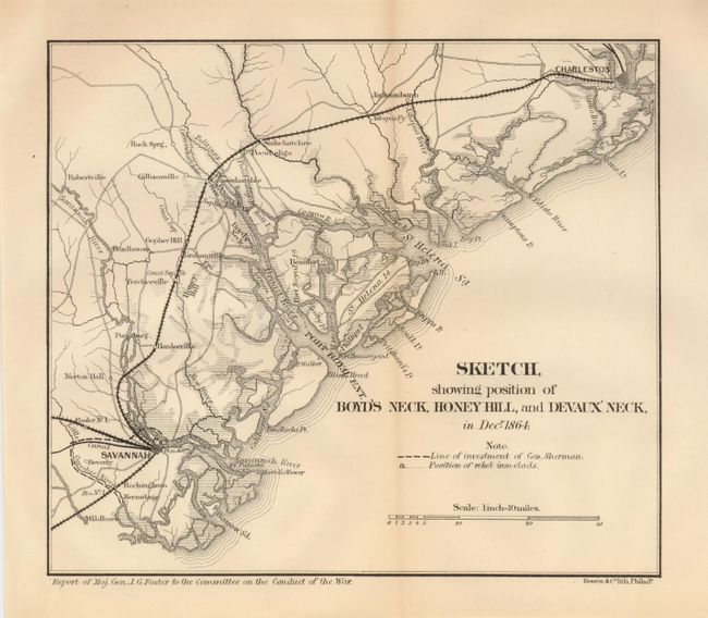
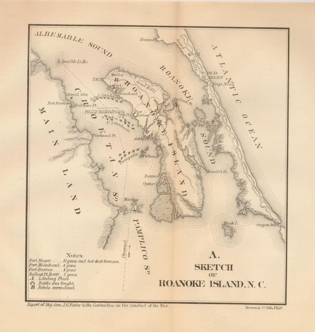
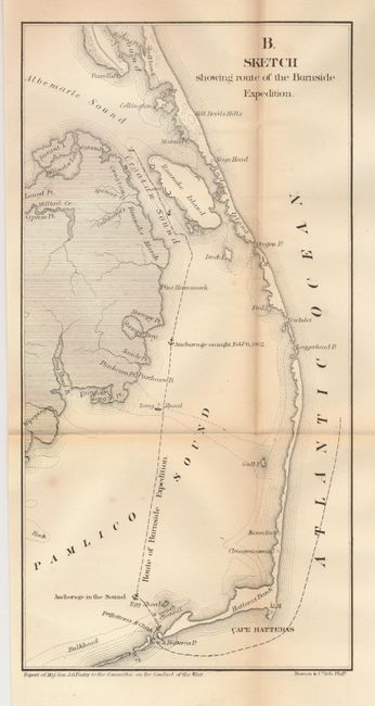
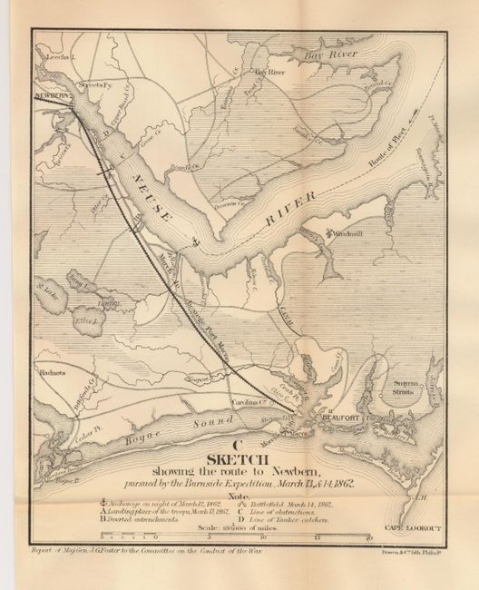
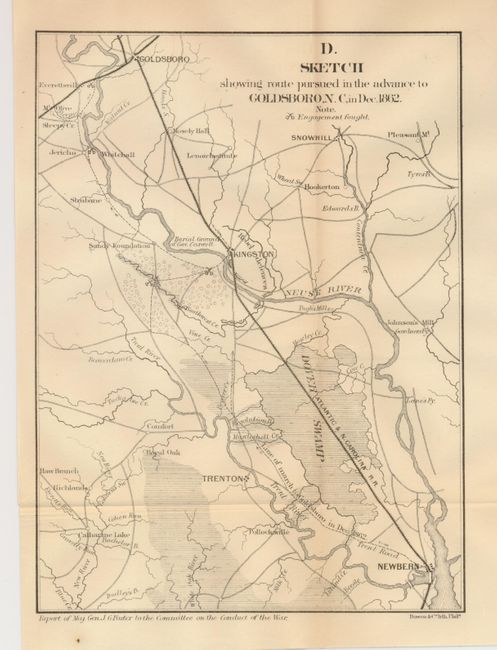
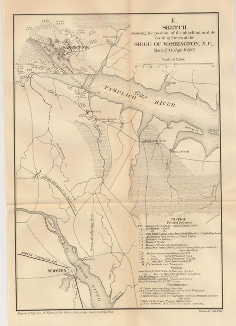
"[Lot of 7 - Civil War]", U.S. War Department

Subject: Southeastern United States, South and North Carolina

Period: 1866 (published)

Publication: Report to the Committee on the Conduct of the War

Color: Black & White

Size:
See Description
Download High Resolution Image
(or just click on image to launch the Zoom viewer)

This fine set of maps portray various Civil War campaigns as published in Major General J.G. Foster's report. These seven maps were published by Bowen & Co. of Philadelphia soon after the end of hostilities. The lot includes:

1) Sketch showing position of Besieging Batteries April 12-13, 1861. (9.1 x 7.3") Ref: Stephenson 386.5. Very good.
2) Sketch showing position of Boyd's Neck, Honey Hill, and Devaux' Neck, in Decr. 1864. (8.4 x 7.3"). Ref: Stephenson 359.5. Very good.
3) A. Sketch of Roanoke Island, N. C. (7 x 6.6"). Ref: Stephenson 317.1. Very good.
4) B. Sketch showing route of the Burnside Expedition (6.1 x 12.1"). Ref: Stephenson 317.12. A little fold toning (B+).
5) C. Sketch showing the route to Newbern, pursued by the Burnside Expedition, March 13, & 14, 1862. (6.8 x 8.5"). Ref: Stephenson 316.8. Very good.
6) D. Sketch showing the route pursued in the advance to Goldsboro, N. C. in Dec. 1862. (7 x 9.5"). Ref: Stephenson 316.5. Very good.
7) E. Sketch showing the position of the attacking and defending forces at the Siege of Washington, N. C. March 29 to April 16, 1863. (8.3 x 11.8"). Ref: Stephenson 317.4. Very good.

References:

Condition: A

All very good except as noted.

Estimate: $100 - $150

Sold for: $80

Closed on 5/20/2009

Archived