Catalog Archive
Auction 127, Lot 312

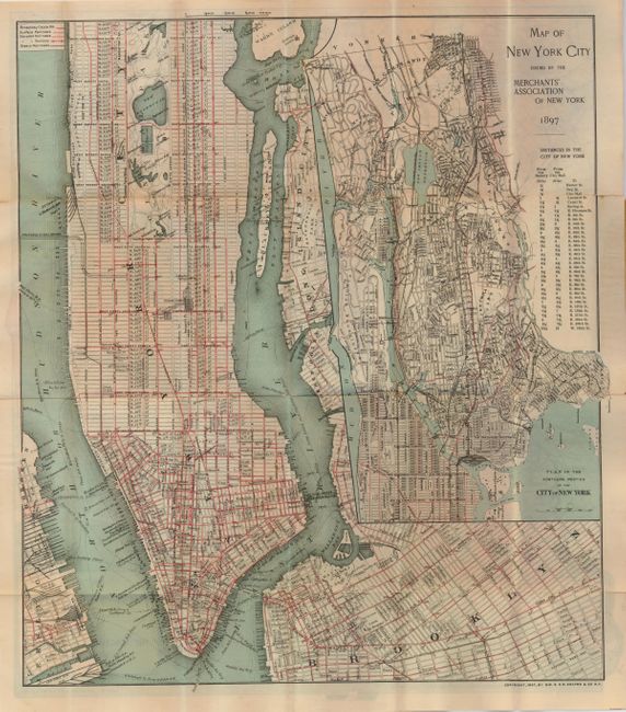
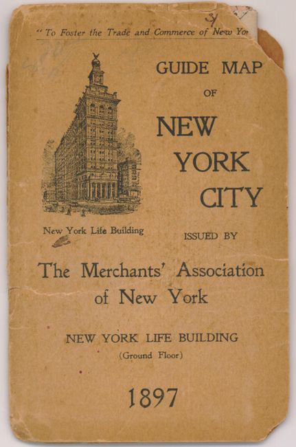
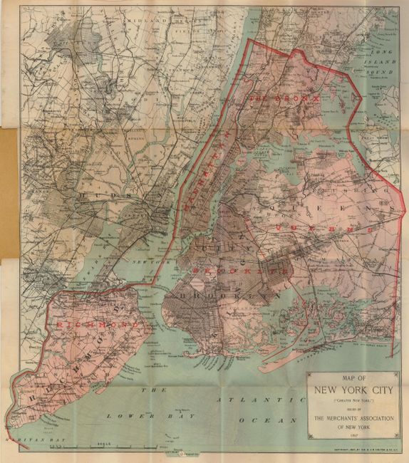
"Map of New York City Issued by the Merchants' Association of New York [verso] Map of New York City (Greater New York)", Colton, G.W. & C.B.

Subject: New York

Period: 1897 (dated)

Publication:

Color: Printed Color

Size:
15 x 17 inches
38.1 x 43.2 cm
Download High Resolution Image
(or just click on image to launch the Zoom viewer)

A late Colton pocket map that covers Manhattan to 109th Street, with parts of Long Island City, Brooklyn and New Jersey. This marketing map was provided compliments of "The Merchants' Association of New York." The very large inset at right "Plan of the Northern Portion of the City of New York" extends the main map up to Yonkers on a larger scale. The focus of the map is the extensive street transportation systems which are highlighted in red overprinting. Different line styles are used to delineate the Broadway Cable R.R., Surface Railroads, Elevated Railroads, and Steam Railroads. Railway stations are identified. The Brooklyn Bridge is clearly shown as "Suspension Bridge," the East River bridge is "under construction" and there is a "Proposed N.Y. & N.J. Bridge" aligned with West 59th Street. Stretching across Blackwell's Island is another bridge. On the verso is a same sized map "Map of New York City ("Greater New York")." Folds into printed wrappers (3.5 x 5.5"), titled "Guide Map of New York City issued by The Merchants' Association of New York." On the inside and back cover is a long list of hotels with addresses and rates (The Waldorf is $3 per night) and the names of 19 of New York's leading daily newspapers.

To our knowledge this map is among the latest known works of George W. and Charles B. Colton. In American Maps and Mapmakers, Ristow says there is no known output by the firm after 1892 and that it is unknown if the firm expired on that year or was taken over by another company. We offered a pocket map of New Jersey a few years ago, the first time we'd seen a Colton dated 1897. This pocket map is the third 1897 edition we've ever seen. A very late Colton issued map.

References: Ristow p. 326.

Condition: C+

With two areas of fold splits, one ending in a short tear, with another short tear into map at right. The front cover is detached and the covers are toned with some chipping at edges or corners.

Estimate: $80 - $120

Sold for: $75

Closed on 2/25/2009

Archived