Catalog Archive
Auction 127, Lot 290

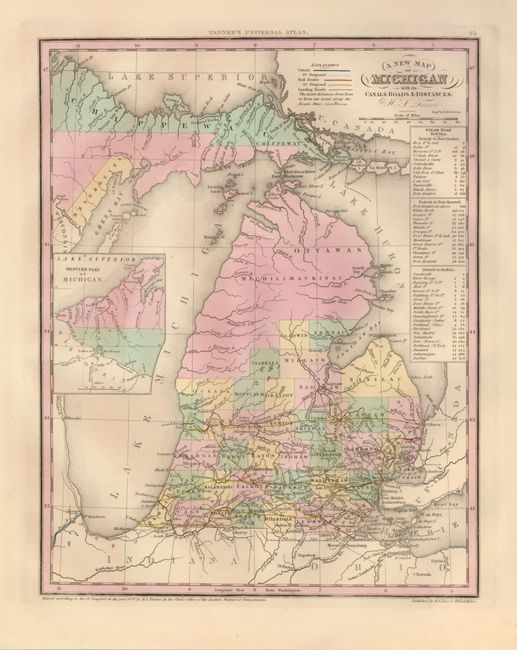
"A New Map of Michigan with its Canals, Roads & Distances", Tanner, Henry Schenck
Subject: Michigan

Period: 1839 (dated)

Publication: New Universal Atlas

Color: Hand Color

Size:
10.6 x 13.6 inches
26.9 x 34.5 cm
Download High Resolution Image
(or just click on image to launch the Zoom viewer)

This is a great early map of Michigan with county development in the southern part of the state. The map was issued just prior to the massive county development that organized the Michilimackinac and Chippewa Districts. There is very little settlement shown above Saginaw and Lansing, the present-day state capital, is not even on the map. Canals and railroads are shown only in the extreme southern portion, highlighted in red and emanating in large part from Detroit. The left portion of the map is inset with the Western Part of Michigan. A table to the right gives the cities and distances along the steamboat routes from Detroit to Fort Gratiot, Detroit to Fort Howard, and Detroit to Buffalo.

References:

Condition: A+

Clean and bright with lovely original color.

Estimate: $200 - $250

Sold for: $425

Closed on 2/25/2009

Archived