Catalog Archive
Auction 127, Lot 249

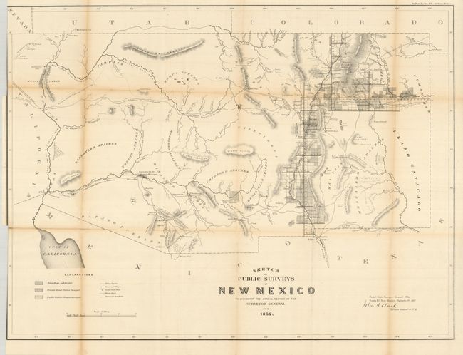
"Sketch of Public Surveys in New Mexico to accompany the Annual Report of the Surveyor General for 1862", General Land Office

Subject: Southwestern United States

Period: 1862 (dated)

Publication: HR Ex Doc No. 1, 37th Congress, 3rd Session

Color: Black & White

Size:
28.2 x 21 inches
71.6 x 53.3 cm
Download High Resolution Image
(or just click on image to launch the Zoom viewer)

Early, large-scale, territorial map by the Surveyor Generals Office, Santa Fe, New Mexico. It includes all of today's Arizona and extends to show the northern reaches of the Sea of Cortez, California at the west and Colorado and Utah to the north. The area of present-day New Mexico is depicted with limited surveying, primarily the settled areas of Santa Fe, Albuquerque and along the valley of the Rio Grande River. Place names include Dona Ana, El Paso and Ft. Bliss, Ft. Craig, Taos, the Hopi Pueblos, San Francisco Mountain, Ft. Buchanan, Ft. Yuma, Tucson, San Xavier, Tubac, and more. The center of the territory is noted as Unexplored. The area of today's Phoenix is Maricopa Wells. Most of Arizona is blank with little cartographic information save a few rudimentary rivers, two Indian Reservations and mountain ranges. Hachuring indicates private land claims, Pueblo Indian grants, and townships subdivided. The next edition will show Arizona Territory. A good example of this most desirable map that is becoming increasingly scarce.

References:

Condition: B+

A very nice example with just light toning to some folds with archival tape on verso to a couple weak folds. Folding as issued with dark impression and full margins.

Estimate: $180 - $220

Sold for: $140

Closed on 2/25/2009

Archived