Catalog Archive
Auction 126, Lot 731

"Tabula Indiae Orientalis", Wit, Frederick de

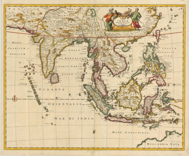
Subject: Southeast Asia

Period: 1662 (dated)

Publication:

Color: Hand Color

Size:
22.5 x 18 inches
57.2 x 45.7 cm
Download High Resolution Image
(or just click on image to launch the Zoom viewer)

This beautiful map of Southeast Asia was engraved by Joannes Lhulier in 1662. The map covers from southeastern Persia to Formosa (Taiwan), the Philippines, and northern Australia. The many islands are clearly depicted, the ports predominate. The map illustrates the sphere of influence of the Dutch East India Company (VOC) which had built a great trading empire throughout the region in the seventeenth century. Ships coming into Batavia (Jakarta) from the Netherlands carried supplies for VOC settlements in Asia. Silver and copper from Japan were used to trade with India and China for silk, cotton, porcelain and textiles. These products were either traded within Asia for the coveted spices from the Celebes or brought back to Europe. This map served as the prototype for Speed's map of the East Indes, which was engraved by Francis Lamb in 1676.

References:

Condition: A

Fine impression and lovely color. There is some expert restoration at lower centerfold and a small tear nearby.

Estimate: $1,100 - $1,400

Sold for: $950

Closed on 12/3/2008

Archived