Catalog Archive
Auction 126, Lot 450

"[2 Sheets] A New and Accurate Map of Europe Divided into its Empires", Kitchin, Thomas
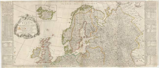
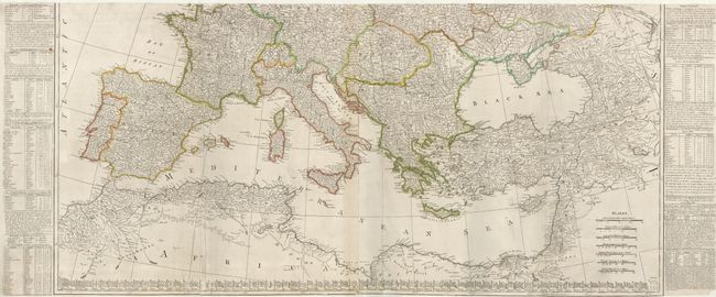
Subject: Europe

Period: 1778 (dated)

Publication:

Color: Hand Color

Size:
42 x 20 inches
106.7 x 50.8 cm
Download High Resolution Image
(or just click on image to launch the Zoom viewer)

This is Kitchin's version of Robert de Vaugondy's detailed four-sheet map of Europe. Named places are shown in abundance and boundaries are included. An inset of Iceland appears above the decorative title cartouche. Tables at sides provide a wealth of information on the major empires, and the flags of all the nations are aligned along the bottom of the southern sheet. This edition was published by Robert Sayer. Printed on four sheets (joined to form two pairs) as issued. The map would measure 42 x 40" if joined.

References:

Condition: B

Original outline color. The map has been professionally backed with heavy tissue to repair tears and fold separations. There are a few stains in the upper sheet.

Estimate: $500 - $800

Sold for: $375

Closed on 12/3/2008

Archived