Catalog Archive
Auction 126, Lot 446

"Europa das ein Drittheil der Erden nach Gelegenheit unsern Zeiten", Munster, Sebastian
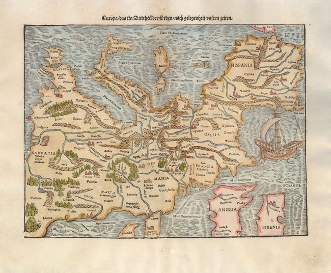
Subject: Europe

Period: 1578 (published)

Publication: Cosmographie

Color: Hand Color

Size:
13.5 x 10 inches
34.3 x 25.4 cm
Download High Resolution Image
(or just click on image to launch the Zoom viewer)

This is one of the earliest obtainable maps of the European continent. Its unusual orientation, with north at the bottom of the sheet and the Mediterranean Sea at top, also makes it one of the most interesting maps of Europe. Mountains, forests, rivers and towns fill the land and in the Atlantic Ocean there is a large sailing ship. Sebastian Munster was the first to make individual maps of each continent, and this map is from that series. The map was issued in both Munster's Geographia and Cosmographia. The verso has a title block with German text and is illustrated with an exquisite figural engraving generally attributed to Hans Holbein.

References: Potter, p. 98.

Condition: A

A couple of binding holes in the blank margins have been professionally repaired.

Estimate: $900 - $1,300

Sold for: $950

Closed on 12/3/2008

Archived