Catalog Archive
Auction 126, Lot 316

"A Map of the Country between Crown Point and Fort Edward", Anon.
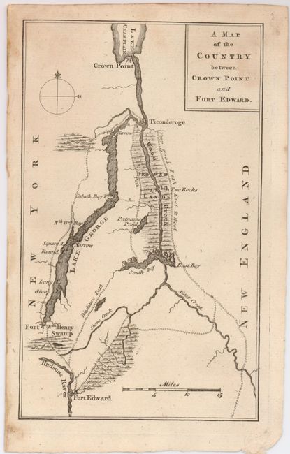
Subject: New York

Period: 1759 (published)

Publication: Gentleman's Magazine

Color: Black & White

Size:
4.5 x 7.5 inches
11.4 x 19.1 cm
Download High Resolution Image
(or just click on image to launch the Zoom viewer)

This map details the region in northern New York that was the theater of much of the French and Indian War. The map covers from Crown Point on Lake Champlain to Fort Edward on the Hudson and Fort William Henry on Lake George. Also shown are trails in the area and a large body of Drown'd Lands along Wood Creek to the south of Fort Ticonderoga. One of the trails is labeled Dieskau's Path referring to the route taken by French and Indian forces under the command of German Baron Ludwig August Dieskau and British and Colonial troops under Sir William Johnson that resulted in a series of skirmishes and engagements known collectively as The Battle of Lake George. This battle was the first significant win against the French forces by British Provincials. The map was published in the May 1759 edition of the Gentleman's Magazine.

References: Jolly GENT-129.

Condition: B+

A little light foxing in title block and at upper edge of map. Otherwise a near fine example that features a strong impression.

Estimate: $160 - $200

Sold for: $120

Closed on 12/3/2008

Archived