Catalog Archive
Auction 126, Lot 213

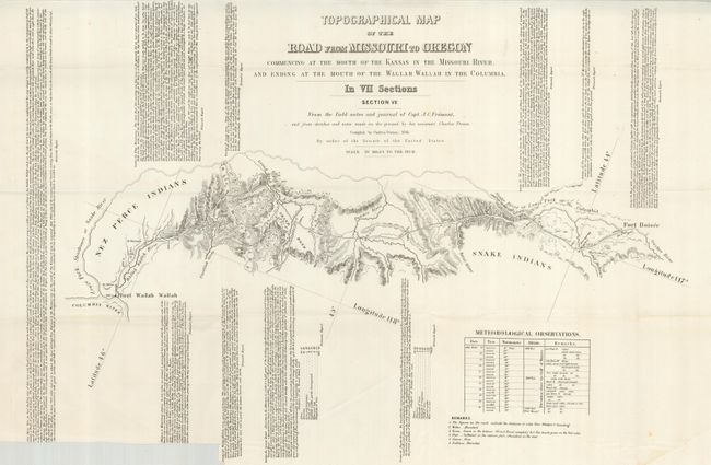
"[Lot of 5] Topographical Map of the Road from Missouri to Oregon… Section III - VII", Fremont, John Charles

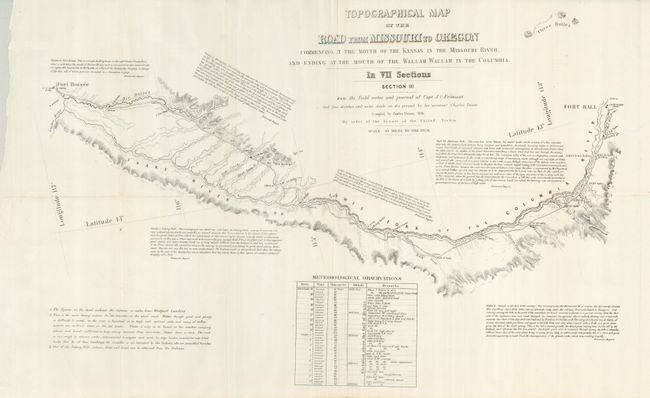
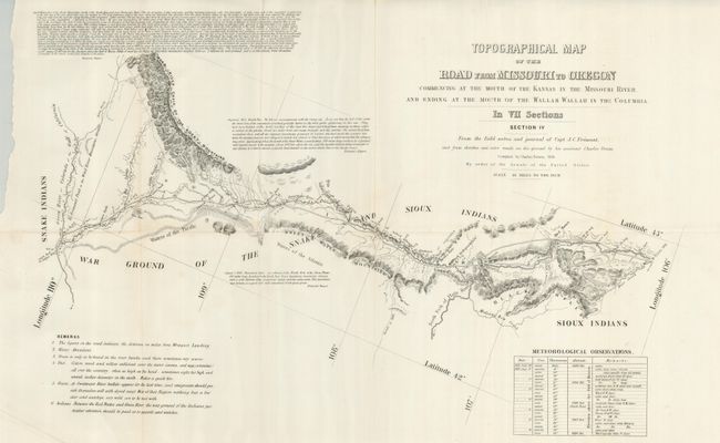
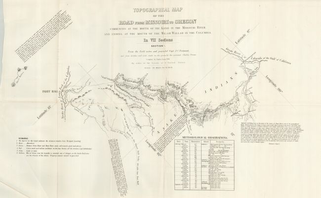
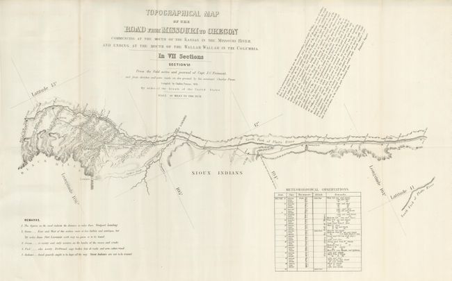
Subject: Western United States

Period: 1846 (dated)

Publication:

Color: Black & White

Size:
23 x 15 inches
58.4 x 38.1 cm
Download High Resolution Image
(or just click on image to launch the Zoom viewer)

This is a partial set of the historical maps compiled by Charles Preuss during Fremont's controversial Third Expedition. Preuss created his rare seven-part map from Fremont's map of 1845 with additional topography not included on the parent map. He used Fremont's sketches and notes as well as his own expedition notes. This collection is missing sheets I and II, with sheet III beginning at Fort Hall. Wheat calls this set of maps a rarity that is important in the "evolution of the transcontinental wagon roads" and deserves "close study." Wheat devotes four pages to describe the maps and illustrates all seven in his monumental work. The map was published as a public document by order of the Senate. Together the full set covers the region "commencing at the Mouth of the Kansas in the Missouri River, and Ending at the Mouth of the Wallah Wallah in the Columbia" - thus the Oregon Trail Route. Each sheet contains fascinating comments from Fremont's narrative and notes regarding water, grass, fuel, game and Indians; invaluable information for emigrants at the time. An exceptional set of the second state of these rare and historically important maps. The second state eliminates the citation "Lithog. By E. Weber & Co. Baltimore" as the last line of the title and has the sections labeled out of order. The lot includes the following five of seven sections:

Section III follows the Lewis Fork of the Columbia River (Snake River) from Fort Hall to Fort Boisee.
Section IV travels through Indian country between Red Buttes and Green River.
Section V continues north of Salt Lake to Fort Hall on the Snake River.
Section VI passes through Fort Laramie along the North Fork of the Platte River. "Sioux Indians are not to be trusted."
Section VII picks up from Fort Boisee ending at Fort Wallah Wallah.

References: Wheat (TMW) #523.

Condition: A+

All folding, as issued. Each is bright and clean. The seventh sheet has a 1" x 8" trim at lower left with a little loss to note text, not affecting map.

Estimate: $1,400 - $2,000

Sold for: $800

Closed on 12/3/2008

Archived