Catalog Archive
Auction 126, Lot 210

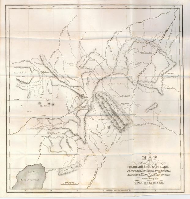
"A Map of the Sources of the Colorado & Big Salt Lake, Platte, Yellow-Stone, Muscle-Shell, Missouri; & Salmon & Snake Rivers, branches of the Columbia River", Bonneville, Benjamin L. E. de

Subject: Western United States

Period: 1837 (published)

Publication: The Rocky Mountains: or Scenes, Incidents, and Adventures in the Far West…

Color: Black & White

Size:
15.5 x 16.3 inches
39.4 x 41.4 cm
Download High Resolution Image
(or just click on image to launch the Zoom viewer)

An important map of the region of the present-day intersection of Idaho, Montana, Wyoming and Utah. Wheat considered the map the best representation of the region during this period. It shows the headwaters of the Wind, Sweetwater, Green (Colorado of the West), Snake, and Salmon Rivers relatively accurately. The course of the Bear River to Lake Bonneville (Salt Lake), the Three Tetons and the 3 Buttes east of the Great Lava Plain are surprisingly well located on this early map.

References: Wheat (TMW) #423.

Condition: B+

Folding as issued. Early impression and full margins with a little offsetting visible in blank areas from heavy impression, otherwise a beautiful, fine example.

Estimate: $700 - $900

Sold for: $550

Closed on 12/3/2008

Archived