Catalog Archive
Auction 126, Lot 145

"Map of the United States Showing the Regions Producing the Principal Types of Tobacco", U.S. Department of Interior

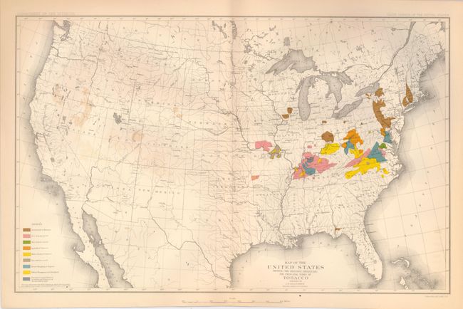
Subject: United States

Period: 1881 (circa)

Publication: Tenth Census

Color: Hand Color

Size:
16.3 x 10.3 inches
41.4 x 26.2 cm
Download High Resolution Image
(or just click on image to launch the Zoom viewer)

This thematic map details the production of tobacco in the United States. The legend uses color to locate nine different tobacco types including Havana, Spangled, Red Shipping, Sun and Air cured, and more. The map still shows Dakota as a single large territory. The map was prepared by J.B. Killebrew, Special Agent, 10th Census. Printed by Julius Bien & Co. Lith, NY.

References:

Condition: A

Some very light offsetting in west from the strongly colored brown areas, otherwise a fine example.

Estimate: $80 - $100

Sold for: $60

Closed on 12/3/2008

Archived