Catalog Archive
Auction 126, Lot 124

"A New and Accurate Map of North America, Drawn from the Famous Mr. D'Anville with Improvements…", Seale, Richard William

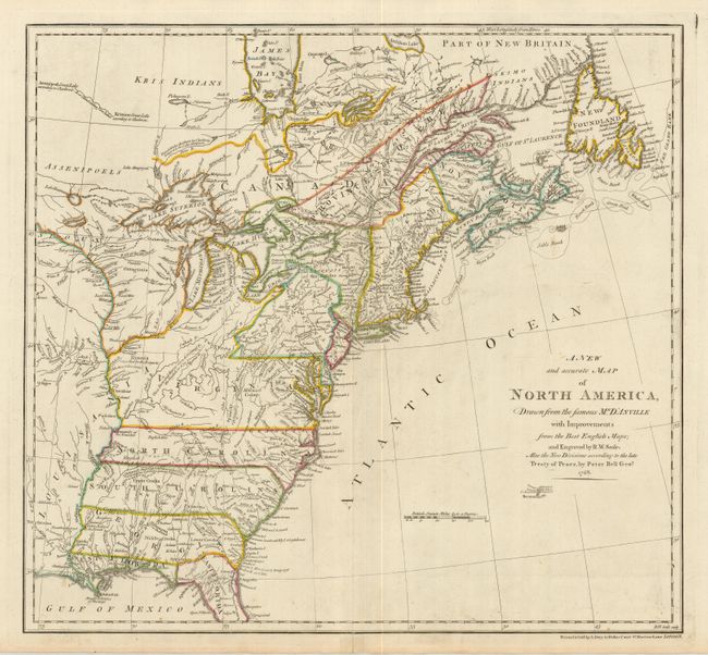
Subject: Colonial United States and Canada

Period: 1768 (dated)

Publication:

Color: Hand Color

Size:
20 x 18.5 inches
50.8 x 47 cm
Download High Resolution Image
(or just click on image to launch the Zoom viewer)

This handsome map illustrates the expansion of the American colonies following the British victory in the French and Indian War. It covers the eastern part of North America from James Bay to Cape Canaveral. It provides a wealth of information including towns and cities, forts, Indian villages and tribal territory. There are several historical and descriptive notations in the newly acquired territories between the Appalachian Mountains and the Mississippi River. Virginia is shown to incorporate the region between the Ohio River and Illinois River and a note proudly proclaims "These Parts and Rivers were discovered by the English in 1634." New York reaches north to take in that part of present-day Ontario that borders the Great Lakes. The map is based on the cartography of D'Anville with the political divisions per Peter Bell, according to the Treaty of Peace. This map went through numerous editions and the early editions such as this example are very uncommon.

References: McCorkle #768.1; cf Sellers & Van Ee 119; cf Stevens & Tree #60.

Condition: A

Sharp impression with original outline color and a tiny fold separation in the bottom margin that just enters the border, else fine.

Estimate: $1,800 - $2,200

Sold for: $1,100

Closed on 12/3/2008

Archived