Catalog Archive
Auction 126, Lot 113

"Karte von der Insel Montreal und den Gegenden Umher…", Bellin, Jacques Nicolas

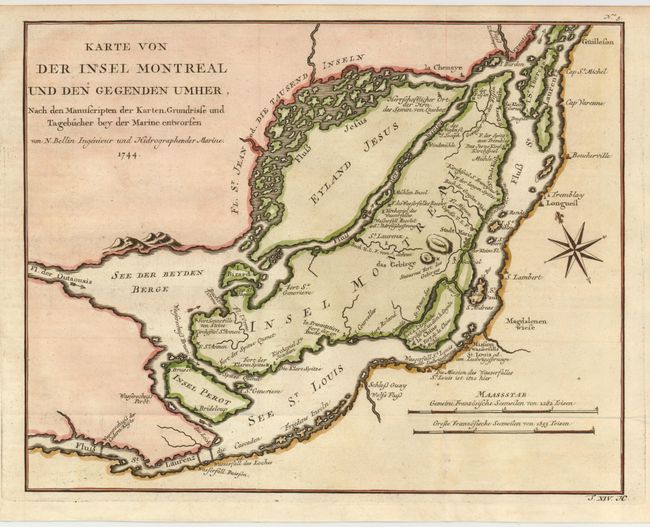
Subject: Canada, Montreal

Period: 1744 (dated)

Publication: Allgemeine Historie der Reisen zu Wasser und zu Lande

Color: Hand Color

Size:
12.2 x 9.5 inches
31 x 24.1 cm
Download High Resolution Image
(or just click on image to launch the Zoom viewer)

This is a German version of Bellin's map of the islands of Montreal and Jesus in great detail. Montreal (here Stadt Maria) is depicted as a walled and fortified city. Forts Karen Spitze, Se. Annen, Senneville, Se. Geneviere, Roland, la Chine, etc. are located; as are the surrounding islands of Se. Therese, Ronde, Se. Helen, Perot and Bizard. Two distance scales and compass rose add interest to the fine chart. Dated 1744, but published in 1756 by Arkstee & Merkus.

References: Kershaw #1089.

Condition: A+

Issued folding, now flattened.

Estimate: $160 - $200

Sold for: $120

Closed on 12/3/2008

Archived