Catalog Archive
Auction 125, Lot 95

"L'Amerique Septentrionale et les Terres Polaires Arctique", Fer, Nicolas de

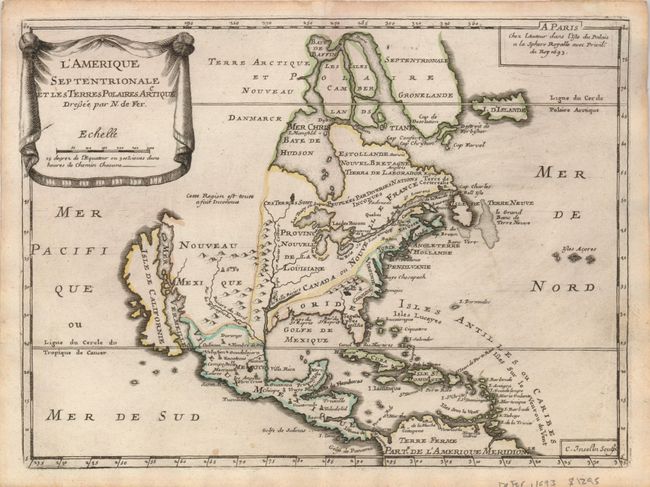
Subject: North America

Period: 1693 (dated)

Publication: Petit et Nouveau Atlas

Color: Hand Color

Size:
11 x 8 inches
27.9 x 20.3 cm
Download High Resolution Image
(or just click on image to launch the Zoom viewer)

This uncommon map is based on Coronelli's large, two-sheet depiction of the continent from 1692. California is depicted as an island on the second Sanson model with two indented bays in the northern coast. There are a couple variations from Coronelli's cartography; Lake Ontario has been absorbed into the St. Lawrence, which now stops short of the Great Lakes, and Baffin Island is shown. The map is small and thus not heavily detailed, but the eastern coast includes the names of Boston, New York, Providence, Chesapeake Bay, Virginia, Carolina and Florida. The title is displayed on a drape-style cartouche. Engraved by C. Inseln.

References: Burden #696; McLaughlin #111.

Condition: A

Original outline color. A couple of faint spots on map and linen hinge remnants on verso

Estimate: $800 - $900

Sold for: $550

Closed on 9/24/2008

Archived