Catalog Archive
Auction 125, Lot 818

"A New Map of Africa wherein are particularly express'd the European Forts and Settlements. Drawn from the most approved Geographers, with great Improvements from the Sieurs D'Anville & Robert.", Sayer, Robert
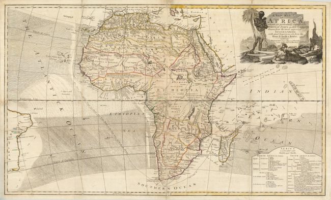
Subject: Africa

Period: 1775 (circa)

Publication:

Color: Hand Color

Size:
36.5 x 22.3 inches
92.7 x 56.6 cm
Download High Resolution Image
(or just click on image to launch the Zoom viewer)

Unusual for maps of Africa produced during this period, the interior has more detail and does not display the usual spurious cartography. The Nile originates in a single lake named Tazana that lies well to the north of the equator with no mention of the Mountains of the Moon. It is filled with notations such as "This Country is wholly unknown to the Europeans." Extends west to show part of the coast of Brazil and east to the Maldives in the Indian Ocean. The map is fully engraved and packed with information worthy of further study. Large pictorial cartouche features an African man, lion and a crocodile. At lower right is a large table listing the countries and regions and their subdivisions and Colonial holders. A scarce issue for which we find no references or catalog listings. We found only two copies listed in collections on the Internet; one in the British Library and the second in the Bell Library at the University of Minnesota.

References:

Condition: B+

Issued folding, now flattened. Some repairs on verso to fold splits as often seen in large maps printed on thick paper. A little foxing or surface soiling, but still a very nice example for a map of this size.

Estimate: $400 - $600

Sold for: $950

Closed on 9/24/2008

Archived