Catalog Archive
Auction 125, Lot 816

"Mappa Geographica Exhibens Religionem Catholicam Alicubi per Africam Sparsam", Scherer, Heinrich
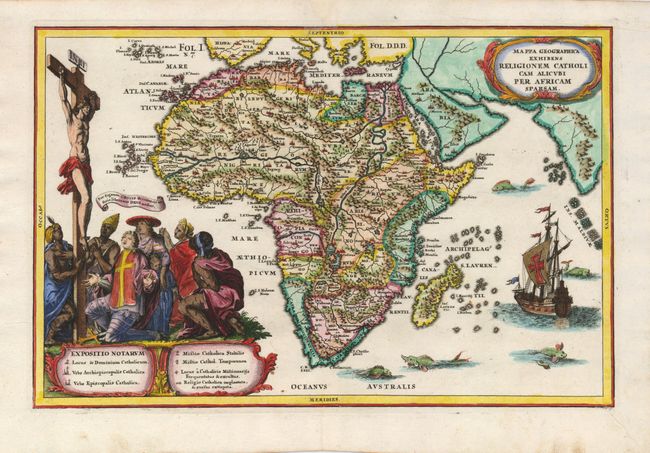
Subject: Africa

Period: 1710 (circa)

Publication: Atlas Novus

Color: Hand Color

Size:
13.7 x 9 inches
34.8 x 22.9 cm
Download High Resolution Image
(or just click on image to launch the Zoom viewer)

The Christian theme of this map of Africa is boldly presented in the graphic illustration of the Crucifixion above the map's key. The map itself is a fine example of the state of geographic knowledge (or lack thereof) at the beginning of the 18th century. The continent is presented with a fairly accurate coastline, but most of the interior is entirely fictional with Scherer unique and complicated river system. The Nile is shown in the traditional manner with its source in the large southern lakes of Zaflan and Zembre. The Zembre, also labeled Lac Zaire spawns the Congo and Zaire Rivers as well. The locations of Catholic churches and missions are prominently shown. The seas abound with a variety of fascinating sea monsters and a large ship with a cross on its sail fills the Indian Ocean.

References:

Condition: A

Nice impression on a sheet with a minor repair in the top margin and a tiny spot near the lower left illustration.

Estimate: $600 - $750

Sold for: $550

Closed on 9/24/2008

Archived