Catalog Archive
Auction 125, Lot 476

"[Lot of 2] Anglia", Ortelius, Abraham

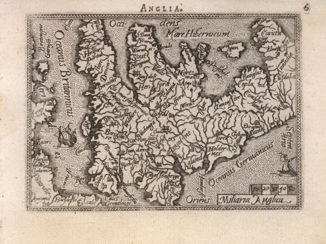
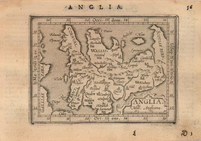
Subject: England & Wales

Period: 1577-1601 (circa)

Publication: Epitomeā€¦

Color: Black & White

Size:
4.3 x 3 inches
10.9 x 7.6 cm
Download High Resolution Image
(or just click on image to launch the Zoom viewer)

Fine pair of miniature maps of England and Wales from two different editions of Ortelius' pocket atlas. Both are oriented with north to the right of the map.
The first map (4.3 x 3") is surrounded in a narrow decorative border and is embellished with two sailing ships. Numerous rivers dominate the map. This map is from an early Latin edition published by Philip Galle.
The second map (4.5 x 3.4") portrays only a few major rivers and locates important cities. A broad border with latitude and longitude markings surround the map and the title is contained in a strapwork cartouche. This map was engraved by the brothers Ambrose and Ferdinand Arsenius from Philip Galle's 1598 edition. It was published in the German edition by Jan Keerbergen.

References: King (1st ed.) p. 140-42 and (2nd ed.) p. 60 & 86.

Condition: A

Second map is lightly toned.

Estimate: $300 - $400

Unsold

Closed on 9/24/2008

Archived