Catalog Archive
Auction 125, Lot 420

"A Mapp of the Sommer Islands… - Mappa Aestivarum Insularum…", Speed, John
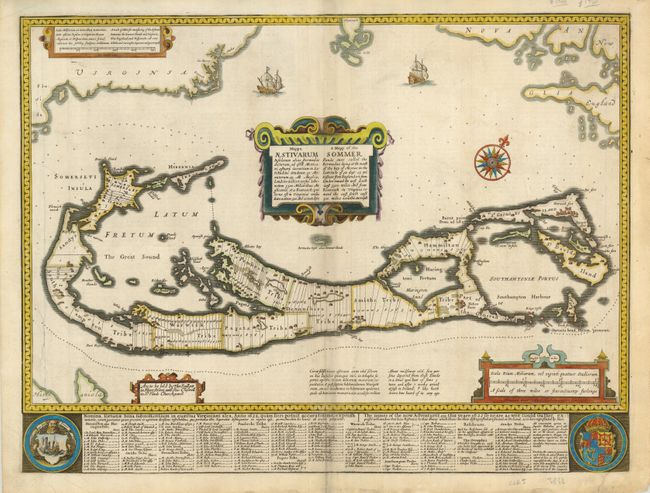
Subject: Bermuda

Period: 1676 (circa)

Publication: A Prospect of the Most Famous Parts of the World

Color: Hand Color

Size:
20.3 x 13.7 inches
51.6 x 34.8 cm
Download High Resolution Image
(or just click on image to launch the Zoom viewer)

This magnificent map was compiled in 1622 by Richard Norwood. It is the first English printed map published in an atlas to show Bermuda divided into Tribes and Shares. These divisions designated the properties given to the 'Adventurers,' led by Sir George Sommers, who were shipwrecked there in 1609. Speed's map became the standard map of the 17th century and was copied by Blaeu, Jansson, Ogilby and others. The title is in both English and Latin. The map was beautifully engraved by Abraham Goos in Amsterdam for Speed's Prospect and his signature appears below the scale of miles. The imprint of Bassett and Chiswell is at left. The map is embellished with sailing ships, a compass rose, four cartouches and two coats of arms. English text on verso.

References: Imago Mundi #40, p.140; Palmer (MCC-19) #6.

Condition: B+

There is some soil on the centerfold, which is reinforced with paper on verso. A short tear just entering the plate at bottom right repaired on verso with archival tape.

Estimate: $2,500 - $3,000

Sold for: $1,900

Closed on 9/24/2008

Archived